سدودو
| Kasikili Island (Namibia) | |
|---|---|
|
نهر تشوبى وسدودو
| |
جزيرة سـِدودو Sedudu Island | |
| الجغرافيا | |
| المسقط | نهر تشوبى بالقرب من الحدود الناميبية |
| الإحداثيات | Coordinates: |
| إجمالي الجزر | 1 |
| المساحة | 5 kم2 (1.9 ميل2) |
| الإدارة | |
| الديمغرافيا | |
| التعداد | غير مأهولة |
| معلومات إضافية | |
| النزاع الإقليمي مع ناميبيا حلـَّته محكمة العدل الدولية في 1999 | |
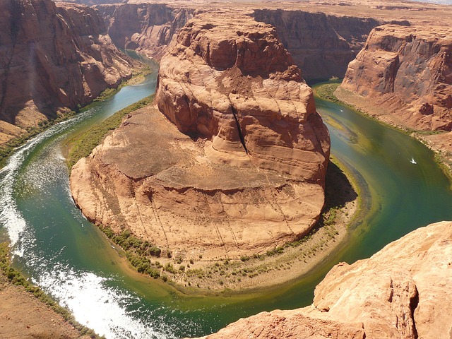
جزيرة سـِدودو (Sedudu ، وتُعهد أيضاً بإسم جزيرة كاسيكيلي Kasikili في ناميبيا) هي جزيرة طميية في نهر تشوبى، في بوتسوانا بالقرب من الحدود مع ناميبيا، بالقرب من بلدة كاسانى البتسوانية. كانت الجزيرة محل نزاع بين البلدين، حله قرار محكمة العدل الدولية عام 1999، التي حكمت فيه لصالح بتسوانا. "كاسيكيلي" هوالاسم الناميبي، و"سـِدودو" هوالاسم البوتسواني للجزيرة. تقدر مساحة الجزيرة بحواليخمسة كم². ولا يوجد بها سكان دائمون؛ لعدة أشهر في السنة، حيث يغمرها مياه الفيضان بداية من شهر مارس.
النزاع الإقليمي
نشأ النزاع من الصياغة غير المحـْكمة لاتفاقية الحد الشمالي بين القوى الاستعمارية، ألمانيا والمملكة المتحدة، اللتين توصلتا لتسوية مصالحهما الجغرافية بين جنوب غرب أفريقيا الألماني ومحمية بتشوانالاند في معاهدة هليگولاند-زنزبار المسقطغة في 1 يوليو1890. هذه المعاهدة تنص "في جنوب غرب أفريقيا، فإن دائرة نفوذ ألمانيا تُعرَّف كالتالي":[1]
To the east by the line that commences at the aforementioned point and follows the 20th degree of east longitude to its intersection point with the 22nd degree of south latitude. The line then traces this degree of latitude eastward to its intersection with the 21st degree of east longitude, follows this degree of longitude northward to its intersection with the 18th degree of south latitude, runs along this degree of latitude eastward to its intersection with the نهر تشوبى. Here it descends the thalweg of the main channel until it meets the Zambezi, where it ends. It is understood that under this arrangement Germany shall be granted free access from its protectorate to the Zambezi by means of a strip of land not less than twenty English miles [30 كم] wide at any point. دائرة نفوذ بريطانيا العظمى يحدها من الغرب وشمال الغرب الخط الموصوف سابقاً وتضم بحيرة نگامي.
البلد الحالي ناميبيا كان جنوب غرب أفريقيا الألماني في 1890؛ بوتسوانا كانت تُعهد آنذاك بإسم محمية بتشوانالاند.
Namibia and Botswana reached a Special Agreement in 1996 to resolve their dispute by taking it to the ICJ. Under the terms of the Special Agreement, the two countries asked the Court to "determine, on the basis of the Anglo-German Treaty of 1 July 1890 and the rules and principles of international law, the boundary between Namibia and Botswana around Kasikili/Sedudu Island and the legal status of the island".
قرار محكمة العدل الدولية
According to the text of the 1890 Treaty, Great Britain and Germany located the dividing line between their spheres of influence in the "main channel" of the Chobe River. The real dispute between the countries concerned the location of that "main channel", with Botswana contending that it was the channel running north of Sedudu Island and Namibia saying the channel ran south of the island. However, since the 1890 Treaty did not define the notion of "main channel", the Court itself had to determine which was the main channel of the Chobe River around the island.
To do so, the Court took into consideration the depth and the width of the channel, the flow (i.e., the volume of water carried), the bed profile configuration and the navigability of the channel. After considering the figures submitted by both parties, as well as surveys carried out on the ground at different periods, the Court concluded that "the northern channel of the River Chobe around Kasikili/Sedudu Island must be regarded as its main channel".
The Court stated that it could not draw conclusions from the cartographic material "in view of the absence of any map officially reflecting the intentions of the parties to the 1890 Treaty" and "in the light of the uncertainty and inconsistency" of the maps submitted by Botswana and Namibia.
The Court considered Namibia's alternative argument that it (and its predecessors) had prescriptive title to Kasikili/Sedudu Island by virtue of the exercise of sovereign jurisdiction over it since the beginning of the century, with full knowledge and acceptance by the authorities of Botswana (and its predecessors). The Court found that while the Masubia of the Caprivi Strip (territory belonging to Namibia) did indeed use the island for many years, they did so intermittently, according to the seasons, and for exclusively agricultural purposes, without it being established that they occupied the island exercising functions of state authority there on behalf of the Caprivi authorities. The Court therefore rejected this argument.
After concluding that the boundary between Botswana and Namibia around Kasikili/Sedudu Island follows the line of deepest soundings in the northern channel of the Chobe and that the island formed part of the territory of Botswana, the Court recalled that, under the terms of an agreement concluded in May 1992 (the "Kasane Communiqué"), the two countries had undertaken to one another that there shall be unimpeded navigation for craft of their nationals and flags in the channels around the island.
جزيرة سدودو، بوتسوانا (2018)
جزيرة كاسيكيلي وقت الفيضان.
المصادر
- ^ "نزاع الجزر". جريدة الشرق الأوسط. 2012-09-21. Retrieved 2012-09-23.
وصلات خارجية
- Documentation of the dispute from the ICJ website
- Science, history and the Kasikili Island dispute: UNESCO reprint of a review of the case by W.J.R. Alexander published in the South African Journal of Science, August 1999, Vol. 95 Issue 8, p321.


