مقاطعة مندوسينو، كاليفورنيا
Mendocino County, California | ||
|---|---|---|
County | ||
| County of Mendocino | ||
|
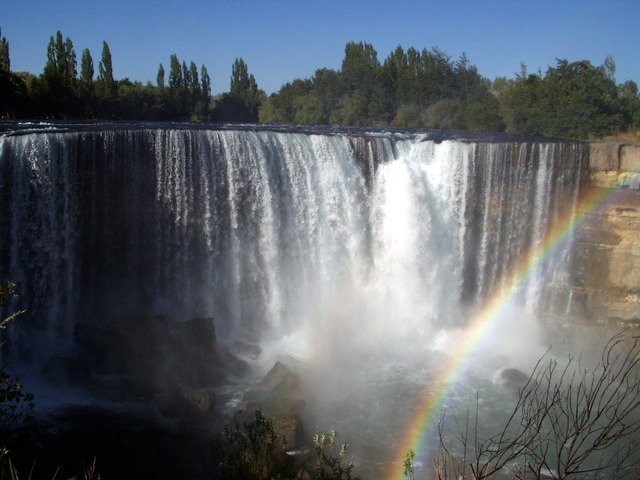
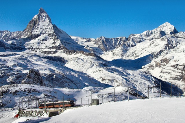
Images, from top down, left to right: The community of Mendocino, the historic Grace Hudson Sun House, Point Arena Lighthouse, the Chandelier Tree, the "Skunk Train", A beach in MacKerricher State Park
| ||
| ||
| Nickname(s): "Mendo"
| ||
|
Location in the state of California
| ||
|
California's location in the الولايات المتحدة
| ||
| Country |
|
|
| State |
|
|
| Region | California North Coast | |
| Incorporated | February 18, 1850 | |
| County seat | Ukiah | |
| Largest city | Ukiah | |
| الحكم | ||
| • الهيئة | Mendocino County Board of Supervisors | |
| المساحة | ||
| • الإجمالية | 3٬878 ميل² (10٬040 كم²) | |
| • البر | 3٬506 ميل² (9٬080 كم²) | |
| • الماء | 372 ميل² (960 كم²) | |
| أعلى ارتفاع | 6٬958 ft (2٬121 m) | |
| التعداد(April 1, 2010) | ||
| • الإجمالي | 87٬841 | |
| • تقدير (2015) | 87٬649 | |
| • الكثافة | 23/sq mi (8٫7/km2) | |
| منطقة التوقيت | Pacific Time Zone (التوقيت العالمي المنسق-8) | |
| • الصيفي | Pacific Daylight Time (UTC-7) | |
| Area code | 707 | |
| المسقط الإلكتروني | co.mendocino.ca.us | |
مقاطعة مندوسينو بالإنگليزية: Mendocino County هي إحدى مقاطعات ولاية كاليفورنيا في الولايات المتحدة الأمريكية.
Geography
According to the U.S. Census Bureau, the county has a total area of 3,878 ميل مربعs (10,040 kم2), of which 3,506 ميل مربعs (9,080 kم2) is land and 372 ميل مربعs (960 kم2) (9.6%) is water.
Rivers
- Russian River (inland)
- Gualala River
- Garcia River
- Elk Creek
- Navarro River
- Albion River
- Little River
- Big River
- Noyo River
- Pudding Creek
- Virgin Creek
- Ten Mile River
- Usal Creek
- Eel River (inland)
Beaches
- Big River Beach
- Caspar Headlands State Beach
- Van Damme Beach
- Greenwood State Beach
- Seaside Beach
- Westport-Union Landing State Beach
- Manchester State Beach
- Navarro Beach
- Portuguese Beach
- Schooner Gulch State Beach
- Long Valley Creek
- 10 Mile Creek
- Glass Beach
National and state protected areas
- Admiral William Standley State Recreation Area
- Caspar Headlands State Recreation Area
- Hendy Woods State Park
- Jug Handle State Reserve
- MacKerricher State Park
- Mailliard Redwoods State Reserve
- Manchester State Park
- Mendocino Coast Botanical Gardens
- Mendocino Headlands State Park
- Mendocino National Forest
- Mendocino Woodlands State Park
- Montgomery Woods State Reserve
- Navarro River Redwoods State Park
- Point Arena State Marine Reserve & Point Arena State Marine Conservation Area
- Point Cabrillo Light Station
- Reynolds Wayside Campground
- Round Valley Indian Reservation
- Russian Gulch State Park
- Saunders Reef State Marine Conservation Area
- Sea Lion Cove State Marine Conservation Area
- Sinkyone Wilderness State Park
- Smythe Redwoods State Reserve
- Standish-Hickey State Recreation Area
- Van Damme State Park
Demographics
2011
| Population, race, and income | |||||
|---|---|---|---|---|---|
| Total population | 87,525 | ||||
| White | 72,596 | 82.9% | |||
| Black or African American | 949 | 1.1% | |||
| American Indian or Alaska Native | 4,273 | 4.9% | |||
| Asian | 1,554 | 1.8% | |||
| Native Hawaiian or other Pacific Islander | 202 | 0.2% | |||
| Some other race | 5,127 | 5.9% | |||
| Two or more races | 2,824 | 3.2% | |||
| Hispanic or Latino (of any race) | 18,964 | 21.7% | |||
| Per capita income | $23,585 | ||||
| Median household income | $44,527 | ||||
| Median family income | $54,083 | ||||
Places by population, race, and income
| Places by population and race | ||||||||
|---|---|---|---|---|---|---|---|---|
| Place | Type | Population | White | Other |
Asian | Black or African American |
Native American |
Hispanic or Latino (of any race) |
| Albion | CDP | 255 | 80.0% | 14.5% | 5.5% | 0.0% | 0.0% | 12.2% |
| Anchor Bay | CDP | 361 | 97.8% | 2.2% | 0.0% | 0.0% | 0.0% | 0.0% |
| Boonville | CDP | 997 | 68.3% | 30.8% | 0.0% | 0.0% | 0.9% | 56.1% |
| Brooktrails | CDP | 3,280 | 91.8% | 2.9% | 2.7% | 0.0% | 2.7% | 3.8% |
| Calpella | CDP | 890 | 79.8% | 9.3% | 2.7% | 5.1% | 3.1% | 6.7% |
| Caspar | CDP | 637 | 97.2% | 2.8% | 0.0% | 0.0% | 0.0% | 0.2% |
| Cleone | CDP | 736 | 100.0% | 0.0% | 0.0% | 0.0% | 0.0% | 20.5% |
| Comptche | CDP | 133 | 100.0% | 0.0% | 0.0% | 0.0% | 0.0% | 33.1% |
| Covelo | CDP | 1,473 | 60.8% | 0.2% | 3.4% | 0.5% | 35.1% | 11.3% |
| Fort Bragg | City | 7,211 | 82.2% | 12.8% | 0.9% | 0.5% | 3.6% | 33.1% |
| Hopland | CDP | 743 | 91.5% | 7.0% | 0.0% | 0.0% | 1.5% | 44.3% |
| Laytonville | CDP | 1,384 | 81.7% | 1.4% | 0.9% | 0.0% | 16.0% | 11.0% |
| Leggett | CDP | 51 | 100.0% | 0.0% | 0.0% | 0.0% | 0.0% | 3.9% |
| Little River | CDP | 261 | 100.0% | 0.0% | 0.0% | 0.0% | 0.0% | 0.0% |
| Manchester | CDP | 163 | 81.6% | 18.4% | 0.0% | 0.0% | 0.0% | 56.4% |
| Mendocino | CDP | 936 | 93.2% | 4.7% | 2.1% | 0.0% | 0.0% | 8.5% |
| Philo | CDP | 325 | 94.2% | 2.5% | 3.4% | 0.0% | 0.0% | 80.0% |
| Point Arena | City | 439 | 90.2% | 9.8% | 0.0% | 0.0% | 0.0% | 43.5% |
| Potter Valley | CDP | 835 | 83.0% | 17.0% | 0.0% | 0.0% | 0.0% | 18.9% |
| Redwood Valley | CDP | 1,378 | 100.0% | 0.0% | 0.0% | 0.0% | 0.0% | 2.5% |
| Talmage | CDP | 974 | 67.1% | 15.4% | 14.6% | 1.2% | 1.6% | 25.7% |
| Ukiah | City | 15,979 | 81.6% | 9.8% | 2.0% | 2.7% | 3.9% | 27.8% |
| Willits | City | 4,896 | 88.9% | 6.9% | 2.0% | 0.2% | 2.1% | 22.1% |
| Places by population and income | |||||
|---|---|---|---|---|---|
| Place | Type | Population | Per capita income | Median household income | Median family income |
| Albion | CDP | 255 | $16,818 | $30,331 | $80,104 |
| Anchor Bay | CDP | 361 | $35,296 | $66,544 | $66,765 |
| Boonville | CDP | 997 | $19,573 | $40,242 | $42,097 |
| Brooktrails | CDP | 3,280 | $25,260 | $46,932 | $52,885 |
| Calpella | CDP | 890 | $15,354 | $39,265 | $50,740 |
| Caspar | CDP | 637 | $30,469 | $74,934 | $74,408 |
| Cleone | CDP | 736 | $25,717 | $43,920 | $68,661 |
| Comptche | CDP | 133 | $16,162 | $2,499 | $24,554 |
| Covelo | CDP | 1,473 | $16,471 | $27,656 | $27,022 |
| Fort Bragg | City | 7,211 | $20,164 | $35,030 | $40,849 |
| Hopland | CDP | 743 | $17,281 | $39,883 | $72,607 |
| Laytonville | CDP | 1,384 | $16,754 | $32,941 | $43,750 |
| Leggett | CDP | 51 | $16,857 | $40,625 | $41,563 |
| Little River | CDP | 261 | $64,048 | $52,188 | $250,001 |
| Manchester | CDP | 163 | $12,548 | $25,972 | $22,625 |
| Mendocino | CDP | 936 | $41,653 | $65,395 | $80,278 |
| Philo | CDP | 325 | $11,826 | $40,875 | $42,188 |
| Point Arena | City | 439 | $17,615 | $31,786 | $41,136 |
| Potter Valley | CDP | 835 | $23,445 | $83,036 | $84,205 |
| Redwood Valley | CDP | 1,378 | $27,334 | $71,719 | $75,313 |
| Talmage | CDP | 974 | $15,445 | $23,448 | $50,208 |
| Ukiah | City | 15,979 | $21,550 | $45,577 | $51,328 |
| Willits | City | 4,896 | $20,709 | $41,195 | $51,457 |
2010
| التعداد التاريخي | |||
|---|---|---|---|
| التعداد | Pop. | %± | |
| 1850 | 55 | — | |
| 1860 | 3٬967 | 7٬112٫7% | |
| 1870 | 7٬545 | 90٫2% | |
| 1880 | 12٬800 | 69٫6% | |
| 1890 | 17٬612 | 37٫6% | |
| 1900 | 20٬465 | 16٫2% | |
| 1910 | 23٬929 | 16٫9% | |
| 1920 | 24٬116 | 0٫8% | |
| 1930 | 23٬505 | −2٫5% | |
| 1940 | 27٬864 | 18٫5% | |
| 1950 | 40٬854 | 46٫6% | |
| 1960 | 51٬059 | 25�0% | |
| 1970 | 51٬101 | 0٫1% | |
| 1980 | 66٬738 | 30٫6% | |
| 1990 | 80٬345 | 20٫4% | |
| 2000 | 86٬265 | 7٫4% | |
| 2010 | 87٬841 | 1٫8% | |
| تقدير 2015 | 87٬649 | −0٫2% | |
| U.S. Decennial Census 1790–1960 1900–1990 1990–2000 2010–2015 | |||
| Population reported at 2010 United States Census | |||||||||
|---|---|---|---|---|---|---|---|---|---|
Population |
more races |
or Latino (of any race) |
|||||||
| Mendocino County | 87,841 | 67,218 | 622 | 4,277 | 1,450 | 119 | 10,185 | 3,970 | 19,505 |
Population |
more races |
or Latino (of any race) |
|||||||
| Fort Bragg | 7,273 | 5,439 | 51 | 160 | 108 | 14 | 1,165 | 336 | 2,313 |
| Point Arena | 449 | 305 | 2 | 1 | 0 | 0 | 118 | 23 | 150 |
| Ukiah | 16,075 | 11,592 | 174 | 601 | 412 | 34 | 2,385 | 877 | 4,458 |
| Willits | 4,888 | 3,862 | 34 | 216 | 68 | 5 | 479 | 224 | 1,008 |
Population |
more races |
or Latino (of any race) |
|||||||
| Albion | 168 | 150 | 1 | 4 | 5 | 0 | 0 | 8 | 4 |
| Anchor Bay | 340 | 301 | 2 | 5 | 2 | 1 | 12 | 17 | 29 |
| Boonville | 1,035 | 630 | 9 | 18 | 7 | 2 | 340 | 29 | 520 |
| Brooktrails | 3,235 | 2,818 | 22 | 87 | 26 | 4 | 109 | 169 | 329 |
| Calpella | 679 | 465 | 3 | 25 | 3 | 0 | 145 | 38 | 256 |
| Caspar | 509 | 474 | 3 | 0 | 8 | 0 | 3 | 21 | 15 |
| Cleone | 618 | 518 | 1 | 3 | 3 | 0 | 79 | 14 | 124 |
| Comptche | 159 | 146 | 0 | 1 | 1 | 0 | 5 | 6 | 10 |
| Covelo | 1,255 | 611 | 14 | 475 | 10 | 0 | 49 | 96 | 163 |
| Hopland | 756 | 521 | 4 | 38 | 10 | 0 | 142 | 41 | 263 |
| Laytonville | 1,227 | 839 | 16 | 244 | 10 | 1 | 60 | 57 | 141 |
| Leggett | 122 | 101 | 0 | 3 | 0 | 0 | 0 | 18 | 4 |
| Little River | 117 | 113 | 0 | 1 | 0 | 0 | 0 | 3 | 2 |
| Manchester | 195 | 151 | 0 | 4 | 1 | 0 | 29 | 10 | 48 |
| Mendocino | 894 | 834 | 5 | 8 | 13 | 1 | 6 | 27 | 42 |
| Philo | 349 | 171 | 2 | 4 | 5 | 0 | 157 | 10 | 204 |
| Potter Valley | 646 | 516 | 2 | 13 | 2 | 0 | 97 | 16 | 154 |
| Redwood Valley | 1,729 | 1,432 | 7 | 63 | 10 | 1 | 155 | 61 | 305 |
| Talmage | 1,130 | 503 | 3 | 27 | 273 | 4 | 278 | 42 | 366 |
Population |
more races |
or Latino (of any race) |
|||||||
| All others not CDPs (combined) | 48,881 | 38,588 | 301 | 2,492 | 541 | 57 | 4,851 | 2,051 | 9,605 |
Communities
Cities
- Fort Bragg
- Point Arena
- Ukiah (county seat)
- Willits
Census-designated places
- Albion
- Anchor Bay
- Boonville
- Brooktrails
- Calpella
- Caspar
- Cleone
- Comptche
- Covelo
- Hopland
- Laytonville
- Leggett
- Little River
- Manchester
- Mendocino
- Philo
- Potter Valley
- Redwood Valley
- Talmage
Unincorporated communities
- Branscomb
- Dos Rios
- Elk
- Gualala
- Inglenook
- Longvale
- Navarro
- Noyo
- Old Hopland
- Piercy
- Pine Grove
- Rockport
- Wanhala
- Westport
- Yorkville
Indian reservations
Mendocino County has nine Indian reservations lying within its borders, the fourth most of any county in the United States (after San Diego County, California; Sandoval County, New Mexico; and Riverside County, California).
- Coyote Valley Reservation
- Guidiville Rancheria
- Hopland Rancheria
- Laytonville Rancheria
- Manchester-Point Arena Rancheria
- Pinoleville Rancheria
- Redwood Valley Rancheria
- Round Valley Reservation (partly in Trinity County)
- Sherwood Valley Rancheria
Population ranking
The population ranking of the following table is based on the 2010 census of Mendocino County.
† county seat
| Rank | City/Town/etc. | Municipal type | Population (2010 Census)
|
|---|---|---|---|
| 1 | † Ukiah | City | 16,075 |
| 2 | Fort Bragg | City | 7,273 |
| 3 | Willits | City | 4,888 |
| 4 | Brooktrails | CDP | 3,235 |
| 5 | Redwood Valley | CDP | 1,729 |
| 6 | Covelo | CDP | 1,255 |
| 7 | Laytonville | CDP | 1,227 |
| 8 | Talmage | CDP | 1,130 |
| 9 | Boonville | CDP | 1,035 |
| 10 | Mendocino | CDP | 894 |
| 11 | Hopland | CDP | 756 |
| 12 | Calpella | CDP | 679 |
| 13 | Potter Valley | CDP | 646 |
| 14 | Cleone | CDP | 618 |
| 15 | Caspar | CDP | 509 |
| 16 | Point Arena | City | 449 |
| 17 | Round Valley Reservation (partially in Trinity County) | AIAN | 401 |
| 18 | Philo | CDP | 349 |
| 19 | Anchor Bay | CDP | 340 |
| 20 | Redwood Valley Rancheria | AIAN | 238 |
| t-21 | Laytonville Rancheria | AIAN | 212 |
| t-21 | Manchester-Point Arena Rancheria | AIAN | 212 |
| 22 | Manchester | CDP | 195 |
| t-23 | Albion | CDP | 168 |
| t-23 | Sherwood Valley Rancheria | AIAN | 168 |
| 24 | Comptche | CDP | 159 |
| 25 | Coyote Valley Reservation | AIAN | 144 |
| 26 | Pinoleville Rancheria | AIAN | 129 |
| 27 | Leggett | CDP | 122 |
| 28 | Little River | CDP | 117 |
| 29 | Guidiville Rancheria | AIAN | 52 |
| 30 | Hopland Rancheria (Pomo Indians) | AIAN | 38 |
In popular culture
Kate McGarrigle's song "(Talk to Me of) Mendocino," is one of the songs on the McGarrigles' 1975 debut album; it has been covered by Linda Ronstadt on her 1982 album Get Closer, and by the English singer-songwriter John Howard on his 2007 E.P., and also by Bette Midler on her 2014 album It's The Girls.
A song written by Matt Serletic and Bernie Taupin, Mendocino County Line Mendocino County Line released in 2002, is about a love that could not last and cites the 'Mendocino County Line' in the chorus.
See also
- National Register of Historic Places listings in Mendocino County, California
- California Historical Landmarks in Mendocino County, California
Notes
- ^ Other = Some other race + Two or more races
- ^ Native American = Native Hawaiian or other Pacific Islander + American Indian or Alaska Native
Footnotes
- ^ "Chronology". California State Association of Counties. Retrieved February 6, 2015.
- ^ "Anthony Peak". Peakbagger.com. Retrieved March 26, 2015.
- ^ "American Fact Finder - Results". United States Census Bureau. Retrieved April 4, 2016.
- ^ "2010 Census Gazetteer Files". United States Census Bureau. August 22, 2012. Retrieved September 28, 2015.
- ^ U.S. Census Bureau. American Community Survey, 2011 American Community Survey 5-Year Estimates, Table B02001. American FactFinder. Retrieved 2013-10-26.
- ^ U.S. Census Bureau. American Community Survey, 2011 American Community Survey 5-Year Estimates, Table B03003. American FactFinder. Retrieved 2013-10-26.
- ^ U.S. Census Bureau. American Community Survey, 2011 American Community Survey 5-Year Estimates, Table B19301. American FactFinder. Retrieved 2013-10-21.
- ^ U.S. Census Bureau. American Community Survey, 2011 American Community Survey 5-Year Estimates, Table B19013. American FactFinder. Retrieved 2013-10-21.
- ^ U.S. Census Bureau. American Community Survey, 2011 American Community Survey 5-Year Estimates, Table B19113. American FactFinder. Retrieved 2013-10-21.
- ^ U.S. Census Bureau. American Community Survey, 2011 American Community Survey 5-Year Estimates. American FactFinder. Retrieved 2013-10-21.
- ^ U.S. Census Bureau. American Community Survey, 2011 American Community Survey 5-Year Estimates, Table B01003. American FactFinder. Retrieved 2013-10-21.
- ^ "County Totals Dataset: Population, Population Change and Estimated Components of Population Change: April 1, 2010 to July 1, 2015". Retrieved July 2, 2016.
- ^ "U.S. Decennial Census". United States Census Bureau. Retrieved September 28, 2015.
- ^ "Historical Census Browser". University of Virginia Library. Retrieved September 28, 2015.
- ^ Forstall, Richard L., ed. (March 27, 1995). "Population of Counties by Decennial Census: 1900 to 1990". United States Census Bureau. Retrieved September 28, 2015.
- ^ "Census 2000 PHC-T-4. Ranking Tables for Counties: 1990 and 2000" (PDF). United States Census Bureau. April 2, 2001. Retrieved September 28, 2015.
-
^ خطأ استشهاد: وسم
<ref>غير سليم؛ لا نص تم توفيره للمراجع المسماةQF - ^ http://www.census.gov/2010census/
- ^ http://www.census.gov/2010census/popmap/ipmtext.php?fl=3250
- ^ http://www.census.gov/2010census/popmap/ipmtext.php?fl=3115
- ^ http://www.census.gov/2010census/popmap/ipmtext.php?fl=1925
- ^ http://www.census.gov/2010census/popmap/ipmtext.php?fl=2100
- ^ http://www.census.gov/2010census/popmap/ipmtext.php?fl=3735
- ^ http://www.census.gov/2010census/popmap/ipmtext.php?fl=0825
- ^ http://www.census.gov/2010census/popmap/ipmtext.php?fl=2820
- ^ http://www.census.gov/2010census/popmap/ipmtext.php?fl=1400
- ^ http://www.census.gov/2010census/popmap/ipmtext.php?fl=1515
وصلات خارجية
| مشاع الفهم فيه ميديا متعلقة بموضوع Mendocino County, California. |
| Wikivoyage has a travel guide for Mendocino County. |
- No URL found. Please specify a URL here or add one to Wikidata.
- Mendocino County Official Travel Website
- Mendocino County and Coast Travel Directory
- Mendocino County Museum
- Mendocino's Movie History - Information and Video
- Hiking trails in Mendocino County at WikiSpot
نطقب:Cities of Mendocino County, California نطقب:California North Coast
|
ولاية كاليفورنيا |
|
|---|---|
| المواضيع |
المناخ | الثقافة | الأنطقيم | الإقتصاد | الإنتخابات | الجغرافيا | الحكومة | التاريخ السابق | التاريخ الحديث | السياسة | كاليفورنيون |
| المناطق |
أنتلوپ ڤالي | بيگ سور | كاسكيد رينج | ساحل الأوسط | سنترال ڤالي | جزر القناة | وادي كواتشيلا | وادي كونهو| وادي كوكامونگا | وادي الموت | شرق خليج سان فرانسيسكو| شرق كاليفورنيا | المثلث اللازوردي | بلد المضى | الحوض العظيم | لوس أنجلس الكبرى | إنلاند إمپاير | بحيرة تاهو| حوض لوس أنجلس | موهاڤا | شمال خليج سان فرانسيسكو| الساحل الشمالي | شمال كاليفورنيا | أونز ڤالي | شبه الجزيرة | پومونا ڤالي | ردوود إمپاير | نهر الروسي | ساكرامنتوڤالي | وادي سان فرناندو| منطقة خليج سان فرانسيسكو| وادي سان هواكين | وادي سانتا كلاريتا | شاستا كاسكيد | سييرا نـِڤادا | سليكون ڤالي | جنوب خليج سان فرانسيسكو| جنوب كاليفورنيا | تيك كوست | تراي-ڤالي | بلد النبيذ، كاليفورنيا | يوسميتي |
| المناطق الحضرية |
بيكرزفيلد | تشيكو| إل سنترو| فرزنو| لوس أنجلوس–لونگ بيتش–گلنديل | مودستو| مرسد | ناپا | أوكلاند–فريمونت–هايوارد | أوكسنارد، كاليفورنيا–ثاوزند اوكس–ڤنتورا | ردنگ | ريڤرسايد–سان برناردينو–أونتاريو| ساكرامنتو–روزفيل | ساليناس | سان دييگو–كارلسباد–سان ماركوس | سان فرانسيسكو–سان ماتيو–ريدوود سيتي | سان هوزيه–صنيڤيل–سانتا كلارا | سانتا أنا–أنهايم–إرڤاين | سانتا باربارا–سانتا ماريا | سانتا كروز–واتسونفيل | سانتا روزا–پتالوما | ستكتون | ڤاليهو–فيرفيلد | فيسالايا–پورترڤيل | يوبا سيتي |
| مقاطعات |
ألاميدا | ألپاين | أمادور | بوت | كالافيراس | كولوسا | كونترا كوستا | دل نورتى | إل دورادو| فرزنو| گلن | همبولت | إمپريال | إنيو| كيرن | كينگز | ليك | لاسين | لوس أنجلس | ماديرا | مارين | ماريپوسا | مندوسينو| مرسد | مودوك | مونو| مونتري | ناپا | نـِڤادا | اورانج | پليسر | بلوماس | ريڤرسايد | ساكرامنتو| سان بنيتو| سان برناردينو| سان دييگو| سان فرانسيسكو| سان هواكين | سان لويس أوبيسپو| سان ماتيو| سانتا باربرا | سانتا كلارا | سانتا كروز | شاستا | سييرا | سيسكيو| سولانو| سونوما | ستانيسلوس | سوتر | تيهاما | ترينيتي | تولير | توالومي | ڤنتورا | يولو| يوبا |
Coordinates:
|
ولاية كاليفورنيا |
|
|---|---|
| المواضيع |
المناخ | الثقافة | الأنطقيم | الإقتصاد | الإنتخابات | الجغرافيا | الحكومة | التاريخ السابق | التاريخ الحديث | السياسة | كاليفورنيون |
| المناطق |
أنتلوپ ڤالي | بيگ سور | كاسكيد رينج | ساحل الأوسط | سنترال ڤالي | جزر القناة | وادي كواتشيلا | وادي كونهو| وادي كوكامونگا | وادي الموت | شرق خليج سان فرانسيسكو| شرق كاليفورنيا | المثلث اللازوردي | بلد المضى | الحوض العظيم | لوس أنجلس الكبرى | إنلاند إمپاير | بحيرة تاهو| حوض لوس أنجلس | موهاڤا | شمال خليج سان فرانسيسكو| الساحل الشمالي | شمال كاليفورنيا | أونز ڤالي | شبه الجزيرة | پومونا ڤالي | ردوود إمپاير | نهر الروسي | ساكرامنتوڤالي | وادي سان فرناندو| منطقة خليج سان فرانسيسكو| وادي سان هواكين | وادي سانتا كلاريتا | شاستا كاسكيد | سييرا نـِڤادا | سليكون ڤالي | جنوب خليج سان فرانسيسكو| جنوب كاليفورنيا | تيك كوست | تراي-ڤالي | بلد النبيذ، كاليفورنيا | يوسميتي |
| المناطق الحضرية |
بيكرزفيلد | تشيكو| إل سنترو| فرزنو| لوس أنجلوس–لونگ بيتش–گلنديل | مودستو| مرسد | ناپا | أوكلاند–فريمونت–هايوارد | أوكسنارد، كاليفورنيا–ثاوزند اوكس–ڤنتورا | ردنگ | ريڤرسايد–سان برناردينو–أونتاريو| ساكرامنتو–روزفيل | ساليناس | سان دييگو–كارلسباد–سان ماركوس | سان فرانسيسكو–سان ماتيو–ريدوود سيتي | سان هوزيه–صنيڤيل–سانتا كلارا | سانتا أنا–أنهايم–إرڤاين | سانتا باربارا–سانتا ماريا | سانتا كروز–واتسونفيل | سانتا روزا–پتالوما | ستكتون | ڤاليهو–فيرفيلد | فيسالايا–پورترڤيل | يوبا سيتي |
| مقاطعات |
ألاميدا | ألپاين | أمادور | بوت | كالافيراس | كولوسا | كونترا كوستا | دل نورتى | إل دورادو| فرزنو| گلن | همبولت | إمپريال | إنيو| كيرن | كينگز | ليك | لاسين | لوس أنجلس | ماديرا | مارين | ماريپوسا | مندوسينو| مرسد | مودوك | مونو| مونتري | ناپا | نـِڤادا | اورانج | پليسر | بلوماس | ريڤرسايد | ساكرامنتو| سان بنيتو| سان برناردينو| سان دييگو| سان فرانسيسكو| سان هواكين | سان لويس أوبيسپو| سان ماتيو| سانتا باربرا | سانتا كلارا | سانتا كروز | شاستا | سييرا | سيسكيو| سولانو| سونوما | ستانيسلوس | سوتر | تيهاما | ترينيتي | تولير | توالومي | ڤنتورا | يولو| يوبا |