هضبة سيبيريا الوسطى
| هضبة سيبيريا الوسطى | |
|---|---|
| Среднесиби́рское плоского́рье | |
|
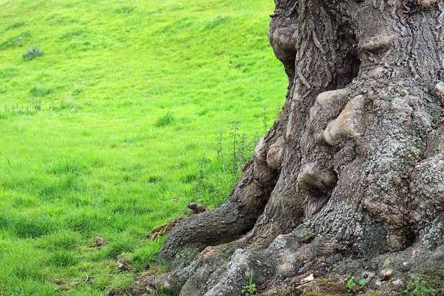
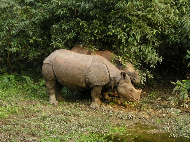
منظر لنهر تونگوسكا الأسفل في هضبة سيبيريا الوسطى
| |
المسقط في روسيا
| |
| المسقط |
كراي كراسنويارسك جمهورية ساخا أوبلاست إركوتسك |
| الإحداثيات | Coordinates: |
| جزء من | سيبيريا |
| الارتفاع | 1,678 مترs (5,505 ft) (highest) |
| الطول | 2,000 كم |
| العرض | 2,000 كم |
| المساحة | 3,500,000 كم² |
هضبة سيبيريا الوسطى (بالروسية: Среднесиби́рское плоского́рье, Srednesibirskoye ploskogorye؛ بالياقوتية: Орто Сибиир хаптал хайалаах сирэ) هي منطقة جبلية شاسعة في سيبيريا، أحد المناطق الروسية الكبرى.
الجغرافيا
تشغل الهضبة جزءاً عظيماً من سيبيريا الوسطى بين the Yenisei and Lena rivers. It is located in the Siberian Platform and extends over an area of 3,500,000 كم²، بين Yenisei في الغرب وCentral Yakutian Lowland in the east. To the south it is bound by the جبال ألطاي، Salair Ridge, Kuznetsk Alatau, the Eastern and Western Sayan Mountains and other mountains of Tuva, as well as the Baikal and Transbaikal mountains. To the north of the plateau lie the North Siberian Lowland and to the east the plateau gives way to the Central Yakutian Lowland and the Lena Plateau.
The surface of the Central Siberian Plateau is characterized by the alternation of wide plateaus and ridges, some of the latter sharply jagged. The Central Siberian Plateau covers one-third of Siberia.
|
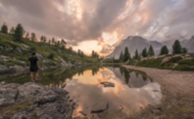
Landscape of the Putorana Nature Reserve.
|
Gold on arsenopyrite as found in the Yenisei Range.
|
الهضاب وسلاسل الجبال الصغرى
The system of the Central Siberian Plateau comprises a number of smaller plateaus and subranges, including, among others, the following:
- Putorana Plateau, the northwesternmost, highest point Mount Kamen (highest of the plateau system) 1,678 مترs (5,505 قدم)
- Anabar Plateau at the northern end
- Vilyuy Plateau
- Syverma Plateau, highest point Nakson, 1,035 مترs (3,396 قدم)
- Tunguska Plateau
- Lena Plateau
- Lena-Angara Plateau
- Yenisei Range, highest point 1,125 م (3,691 قدم)
- Angara Range, highest point 1,022 م (3,353 قدم)
المناخ
The climate is continental with short warm summers and long and severely cold winters. Most of the territory is covered with conifer forests (larch is especially abundant). The plateau's major river is the Lower Tunguska. Known geologically as the Siberian Traps, mineral resources here are very rich and include coal, iron ore, gold, platinum, diamonds and natural gas.
See also
- Economy of Russia — Natural resources
- South Siberian Mountains
- حادث تونگوسكا
- Udachnaya pipe
المراجع
- ^ Russia. Topographic map R-45,46; M 1: 1 000 000
- ^ Среднесибирское плоскогорье (Central Siberian Plateau) / Great Russian Encyclopedia; in 35 vol.] / Ch. ed. Yu.S. Osipov . - M .: Great Russian Encyclopedia, 2004—2017.
- ^ "The Central Siberian Plateau". Encyclopædia Britannica. Retrieved 2007-07-13.
وصلات خارجية
-
 Media related to هضبة سيبيريا الوسطى at Wikimedia Commons
- The Demise of the Siberian Plume
- №1 Travel Guide
نطقب:Siberia-geo-stub