كيريتيماتي
Kiritimati (Christmas Island) | |
|---|---|
Atoll | |
|
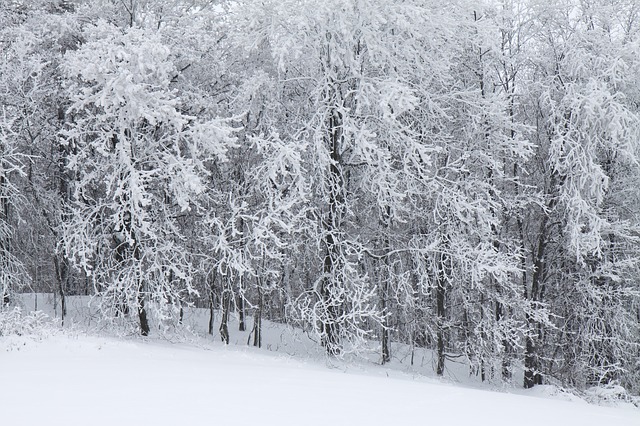
Photograph from the International Space Station
| |
|
Kiritimati (Christmas Island) | |
| الإحداثيات: Coordinates: | |
| Country | Kiribati |
| Island group | Line Islands |
| المساحة | |
| • الإجمالية | 388٫39 كم² (149٫96 ميل²) |
| التعداد(2015 Census) | |
| • الإجمالي | 6٬447 |
| • الكثافة | 17/km2 (43/sq mi) |
Kiritimati or Christmas Island is a Pacific Ocean raised coral atoll in the northern Line Islands. It is part of the Republic of Kiribati. Its name is a respelling of the English word "Christmas" according to the Kiribati language's conventions for the Latin script, in which the combination ti is pronounced s, and the name is thus pronounced //.
The island has the greatest land area of any coral atoll in the world, about 388 kiloمتر مربعs (4.176397242×10⁹ قدم مربعs); its lagoon is roughly the same size. The atoll is about 150 kم (93 ميل) in perimeter, while the lagoon shoreline extends for over 48 kم (30 ميل). Kiritimati comprises over 70% of the total land area of Kiribati, a country encompassing 33 Pacific atolls and islands.
It lies 232 kم (144 ميل) north of the Equator, 2,160 kم (1,340 ميل) south of Honolulu, and 5,360 kم (3,330 ميل) from San Francisco. Kiritimati Island is in the world's farthest forward time zone, UTC+14, and is one of the first inhabited places on Earth to experience the New Year (see also Caroline Atoll, Kiribati). Despite being 2,460 kم (1,530 ميل) east of the 180 meridian, a 1995 realignment of the International Date Line by the Republic of Kiribati moved Kiritimati to west of the dateline.
Nuclear tests were conducted on and around Kiritimati by the United Kingdom in the late 1950s, and by the United States in 1962. During these tests the island was not evacuated. Subsequently, British, New Zealand, and Fijian servicemen as well as local islanders have suffered from exposure to the radiation from these blasts.
The entire island is a Wildlife Sanctuary; access to five particularly sensitive areas (see below) is restricted.
التاريخ
At Western discovery, Kiritimati was uninhabited. As on other Line Islands there might have been a small or temporary native population, most probably Polynesian traders and settlers, who would have found the island a useful replenishing station on the long voyages from the Society Islands to Hawaiʻi. This trade route was apparently used with some regularity by about AD 1000. From 1200 onwards Polynesian long-distance voyages became less frequent, and had there been human settlement on Kiritimati, it would have been abandoned in the early-mid second millennium AD. Two possible village sites and some stone structures of these early visitors have been located. Today, most inhabitants are Micronesians, and Gilbertese is the only language of any significance. English is generally understood, but little used outside the tourism sector.
Kiritimati was discovered to Europeans by the Spanish expedition of Hernando de Grijalva in 1537, that charted it as Acea. This discovery was referred by a contemporary, the Portuguese António Galvão, governor of Ternate, in his book Tratado dos Descubrimientos of 1563.Captain James Cook visited it on Christmas Eve (24 December) 1777.Whaling vessels were visiting the island from at least 1822. It was claimed by the United States under the Guano Islands Act of 1856, though little actual mining of guano took place.
Bridges Point is at the central upper margin.
الوضع الحالي
The island's population has strongly increased in recent years, from about 2,000 in 1989 to about 5,000 in the early 2000s. Kiritimati has two representatives in the Maneaba ni Maungatabu. Today there are five villages, four populated and one abandoned, on the island:
| No. | Village | Population (Census 2015) |
|---|---|---|
| 1 | Tabwakea | 3,001 |
| 2 | London | 1,899 |
| 3 | Banana (Banana Wells) | 1,208 |
| 4 | Poland | 339 |
| 5 | Paris (ruins) | – |
| Christmas Island | 6,447 |
الجغرافيا
Kiritimati's roughly 320 kم2 (120 ميل2) lagoon opens to the sea in the northwest; Burgle Channel (the entrance to the lagoon) is divided into the northern Cook Island Passage and the southern South Passage. The southeastern part of the lagoon is partially dried out today; essentially, progressing SE from Burgle Channel, the 160 kم2 (62 ميل2) main lagoon gradually turns into a network of subsidiary lagoons, tidal flats, partially hypersaline brine ponds and salt pans, which as a whole has about the same area again as the main lagoon. Thus, the land and lagoon areas can only be given approximately, as no firm boundary exists between the main island body and the salt flats.Vaskess Bay is a large bay which extends along the southwest coast of Kiritimati Island.
المناخ
Despite its proximity to the Intertropical Convergence Zone (ITCZ), Kiritimati is located in an equatorial dry zone and rainfall is rather low except during El Niño years; 873 mم (34.4 بوصة) on average per year, in some years it can be as little as 177 mم (7.0 بوصة) and much of the flats and ponds can dry up such as in late 1978. On the other hand, in some exceptionally wet years abundant downpours in March–April may result in a total annual precipitation of over 2,500 mم (98 بوصة). Kiritimati is thus affected by regular, severe droughts. They are exacerbated by its geological structure; climatically "dry" Pacific islands are more typically located in the "desert belt" at about 30°N or S latitude. Kiritimati is a raised atoll, and although it does occasionally receive plenty of precipitation, little is retained given the porous carbonate rock, the thin soil, and the absence of dense vegetation cover on much of the island, while evaporation is constantly high. Consequently, Kiritimati is one of the rather few places close to the Equator which have an effectively arid climate.
The temperature is constantly between 24 °C and 30 °C (75 °F and 86 °F) with more diurnal temperature variation than seasonal variation. Easterly trade winds predominate.
| بيانات مناخ لندن، كيريتيماتي، كيريباش | |||||||||||||
|---|---|---|---|---|---|---|---|---|---|---|---|---|---|
| الشهر | يناير | فبراير | مارس | أبريل | مايو | يونيو | يوليو | أغسطس | سبتمبر | اكتوبر | نوفمبر | ديسمبر | العام |
| العظمى القياسية °س (°ف) | 31.7 (89) |
32.8 (91) |
33.3 (92) |
33.3 (92) |
33.9 (93) |
32.2 (90) |
32.2 (90) |
32.8 (91) |
32.8 (91) |
33.3 (92) |
33.3 (92) |
32.8 (91) |
33٫9 (93) |
| العظمى المتوسطة °س (°ف) | 29.4 (85) |
29.4 (85) |
30 (86) |
30 (86) |
30.6 (87) |
30.6 (87) |
30 (86) |
30.6 (87) |
30.6 (87) |
30.6 (87) |
30 (86) |
30 (86) |
30٫14 (86٫3) |
| المتوسط اليومي °س (°ف) | 26.7 (80) |
26.7 (80) |
27.2 (81) |
27.2 (81) |
27.2 (81) |
27.2 (81) |
27.2 (81) |
27.8 (82) |
27.2 (81) |
27.2 (81) |
27.2 (81) |
26.7 (80) |
27٫13 (80٫8) |
| الصغرى المتوسطة °س (°ف) | 23.9 (75) |
23.9 (75) |
24.4 (76) |
24.4 (76) |
24.4 (76) |
24.4 (76) |
24.4 (76) |
25 (77) |
24.4 (76) |
23.9 (75) |
24.4 (76) |
23.9 (75) |
24٫31 (75٫8) |
| الصغرى القياسية °س (°ف) | 18.9 (66) |
21.7 (71) |
21.7 (71) |
21.1 (70) |
22.8 (73) |
20 (68) |
22.2 (72) |
21.7 (71) |
20.6 (69) |
20 (68) |
19.4 (67) |
20.6 (69) |
(66) |
| هطول mm (inches) | 25 (1.0) |
71 (2.8) |
64 (2.5) |
206 (8.1) |
89 (3.5) |
81 (3.2) |
51 (2.0) |
15 (0.6) |
3 (0.1) |
3 (0.1) |
8 (0.3) |
15 (0.6) |
630 (24٫8) |
| % Humidity | 77 | 80 | 80 | 83 | 81 | 80 | 78 | 75 | 74 | 74 | 73 | 75 | 77٫5 |
| Avg. precipitation days | 2.4 | 4.6 | 6.0 | 13.8 | 6.8 | 6.1 | 3.0 | 1.8 | 0.1 | 0.3 | 0.7 | 1.7 | 47٫3 |
| Source: Weatherbase | |||||||||||||
البيئة
The flora and the fauna consist of taxa adapted to drought. Terrestrial fauna is scant; there are no truly native land mammals and only one native land bird – Kiribati's endemic reed-warbler, the bokikokiko (Acrocephalus aequinoctialis). The 1957 attempt to introduce the endangered Rimitara lorikeet (Vini kuhlii) has largely failed; a few birds seem to linger on, but the lack of abundant coconut palm forest, on which this tiny parrot depends, makes Kiritimati a suboptimal habitat for this species.
النبيت
الطيور
More than 35 bird species have been recorded from Kiritimati. As noted above, only the bokikokiko (Acrocephalus aequinoctialis), perhaps a few Rimitara lorikeets (Vini kuhlii) – if any remain at all – and the occasional eastern reef egret (Egretta sacra) make up the entire landbird fauna. About 1,000 adult bokikokikos are to be found at any date, but mainly in mixed grass/shrubland away from the settlements.
On the other hand, seabirds are plentiful on Kiritimati, and make up the bulk of the breeding bird population. There are 18 species of seabirds breeding on the island, and Kiritimati is one of the most important breeding grounds anywhere in the world for several of these:
انظر أيضاً الانقراض أدناه.
باقي الوحيش
The only mammals native to the region are the common Polynesian rat (Rattus exulans), and the goat. Indeed, the rat would seem to have been introduced by native seafarers numerous centuries before Cook found Kiritimati in 1777, and the goat is extinct since 14 January 2004. Black rats (Rattus rattus) were present at some time, perhaps introduced by 19th century sailors or during the nuclear tests. They have not been able to gain a foothold between predation by cats and competitive exclusion by Polynesian rats, and no black rat population is found on Kiritimati today.
Up to 2,000 feral cats can in some years be found on the island; the population became established in the 19th century. Their depredations seriously harm the birdlife. Since the late 19th century, they have driven about 60% of the seabird species from the mainland completely, and during particular dry spells they will cross the mudflats and feast upon the birds on the motus. Spectacled tern chicks seem to be a favorite food of the local cat population. There are some measures being taken to ensure the cat population does not grow. That lowering the cat population by some amount would much benefit Christmas and its inhabitants is generally accepted, but the situation is too complex to simply go and eradicate them outright (which is theoretically possible؛ انظر جزيرة ماريون) – انظر أدناه for details. A limited population of feral pigs exists. They were once plentiful and wreaked havoc especially on the Onychoprion and noddies. Pig hunting by locals has been encouraged, and was highly successful at limiting the pig population to a sustainable level, while providing a source of cheap protein for the islanders.
There are some "supertramp" lizards which have reached the island by their own means. Commonly seen are the mourning gecko (Lepidodactylus lugubris) and the skink Cryptoblepharus boutonii; the four-clawed gecko (Gehyra mutilata) is less often encountered.
There are some crustaceans of note to be found on Kiritimati and in the waters immediately adjacent. The amphibious coconut crab (Birgus latro) is not as common as for example on Teraina. Ghost crabs (genus Ocypode), Cardisoma carnifex and Geograpsus grayi land crabs, the strawberry land hermit crab (Coenobita perlatus), and the introduced brine shrimp Artemia salina which populates the saline ponds are also notable.
بيئة الرصيف المرجاني
Overfishing and pollution have impacted on the ocean surrounding the island. In the ocean surrounding uninhabited islands of the Northern Line Islands, Sharks comprised 74% of the top predator biomass (329 g m-2) at Kingman Reef and 57% at Palmyra Atoll (97 g m-2), whereas low shark numbers have been observed at Tabuaeran and Kiritimati.
الحفاظ_والانقراض
In December 1960, the British colonial authority gazetted Kiritimati as a bird sanctuary under the "Gilbert and Ellice Island Colony Wild Birds Protection Ordinance" of 1938. Access to Cook Island, Motu Tabu and Motu Upua was restricted. Kiritimati was declared a Wildlife Sanctuary in May 1975, in accordance with the Wildlife Conservation Ordinance of the then self-governing colony. Ngaontetaake and the sooty tern breeding grounds at North West Point also became restricted-access zones. Two years later, active conservation measures got underway.
Grapple X Round C1, the first successful British hydrogen bomb test, detonates over Kiritimati's South East Point.
There is no reliable data on the environmental and public health impact of the nuclear tests conducted on the island in the late 1950s. A 1975 study claimed that there was negligible radiation hazard; certainly, fallout was successfully minimized. More recently however, a Massey University study of New Zealand found chromosomal translocations to be increased about threefold on average in veterans who participated in the tests; most of the relevant data remains classified to date.
الانقراض
The type specimen of the Tuamotu sandpiper (Prosobonia cancellata) was collected on Kiritimati in 1778, probably on 1 or 2 January, during Captain Cook's visit. The expedition's naturalist William Anderson observed the bird, and it was painted by William Ellis (linked below). The single specimen was in Joseph Banks's collection at the end of the 18th century, but later was lost or destroyed. There is some taxonomic dispute regarding the Kiritimati population. As all Prosobonia seem(ed) to be resident birds unwilling to undertake long-distance migrations, an appropriate treatment would be to consider the extinct population the nominate subspecies, as Prosobonia cancellata cancellata or Kiritimati sandpiper, distinct from the surviving Tuamotu Islands population more than 2,000 km (1,200 mi) to the southeast.
See also
- List of Guano Island claims
- List of islands
- Bay of Wrecks
Notes and references
- ^ Teeb'aki in Scott, Derek A. (1993): Republic of Kiribati Archived 30 August 2018 at the Wayback Machine.. A Directory of Wetlands in Oceania, pp. 199–228. International Waterfowl and Wetlands Research Bureau, Slimbridge, U.K. and Asian Wetland Bureau, Kuala Lumpur, Malaysia.
- ^ Streets, Thomas H. (1877). "Some Account of the Natural History of the Fanning Group of Islands". American Naturalist. 11 (2): 65–72. doi:10.1086/271824. JSTOR 2448050.
- ^ "20. Kiritimati" (PDF). Office of Te Beretitent - Republic of Kiribati Island Report Series. 2012. Archived (PDF) from the original on 14 July 2016. Retrieved 28 April 2015.
- ^ Edward R. Lovell; Taratau Kirata; Tooti Tekinaiti (September 2002). "Status report for Kiribati's coral reefs" (PDF). Centre IRD de Nouméa. Archived (PDF) from the original on 18 May 2015. Retrieved 15 May 2015.
- ^ A Chronological History of the Discoveries in the South Sea Or Pacific Ocean. Volume 1. Page 181-182 Author: James Burney. Editor: Printed by Luke Hansard, 1803
- ^ Spate, Oskar Hermann Khristian (October 2008). "The Spanish Lake The Pacific since Magellan, Volume I; Chapter 4. Magellan's Successors: Loaysa to Urdaneta - Two failures: Grijalva and Villalobos". ANU Press. Archived from the original on 17 July 2014. Retrieved 28 April 2015.
- ^ Maude, H.E. "Spanish discoveries in the Pacific" Journal of the Polynesian Society, Wellington, New Zealand, 1959, Volume 68, No. 4, p 296.
- ^ Brand, Donald D. The Pacific Basin: A History of its Geographical Explorations The American Geographical Society, New York, 1967, p.122.
- ^ Galvano, Antonio The Discoveries of the World, from their First Original unto the Year of our Lord 1555 Hakluyt Society, London, 1865, (Ser. I, no. 30).
- ^ "Christmas Island History: Line Islands, Republic of Kiribati". Jane Resture. Archived from the original onستة January 2017. Retrieved 27 January 2017.
- ^ Robert Langdon (ed.) Where the whalers went; an ibdex to the Pacific ports and islands visited by American whalers (and some other ships) in the 19th century, Canberra, Pacific Manuscripts Bureau, 1984, p.149. ISBN 0-86784-471-X
- ^ "FORMERLY DISPUTED ISLANDS". U.S. Department of the Interior, Office of Insular Affairs. Archived from the original on 30 September 2007.
- ^ Report on the Kiribati 2010 Census of Population and Housing. Vol 1: Basic Information and Tables. Part B: Personal (Population) Tables. Table 3: Population by Village, Sex and Age Group - 2010. S. 50.
- ^ "Weatherbase: Historical Weather for London, Kiribati". Weatherbase. 2011. Archived from the original on 11 June 2016. Retrieved 14 May 2016. Retrieved on November 24, 2011.
- ^ In the strict sense, i.e. excluding the amphibious eastern reef egret
- ^ Stuart A. Sandin; et al. (27 February 2008). "Baselines and Degradation of Coral Reefs in the Northern Line Islands". ثلاثة (2) PLoS ONE. Archived from the original on 1 February 2017. Retrieved 27 January 2017.
- ^ Wolman, David. "This place is the bomb". Salon. Archived from the original on 2 February 2017. Retrieved 2017-01-30.
- ^ Massey University (2008): DNA damage to nuclear test vets prompts call for study of children. Version of 2008-JAN-15. Retrieved 25 March 2008.
- ^ Cook, James (1784): [Birds of Christmas Island]. In: A voyage to the Pacific Ocean, ... performed under the direction of Captains Cook, Clerke, and Gore, in His Majesty's Ships the Resolution and the Discovery, etc. 2: 188–189. London. JPEG fulltext of 2nd (1785) edition
- ^ Townsend, Charles Haskins; Wetmore, Alexander (1919). "Reports on the scientific results of the expedition to the tropical Pacific in charge of Alexander Agassiz, on the U.S. Fish Commission steamer "Albatross", from August, 1899, to March, 1900, Commander Jefferson F. Moser, U.S.N., commanding". Bulletin of the Museum of Comparative Zoology. 63: 151–225.
- ^ Zusi Richard L. & Jehl, Robert R. Jr.; Jehl (1970). (Charadriiformes; Charadrii)" (PDF). Auk. 87 (4): 760–780. doi:10.2307/4083710. Archived (PDF) from the original on أربعة March 2016. Retrieved 2 March 2013.
خطأ استشهاد: الوسم <ref> ذوالاسم "Penhallurick" المُعرّف في <references> غير مستخدم في النص السابق.
خطأ استشهاد: الوسم <ref> ذوالاسم "Steadman" المُعرّف في <references> غير مستخدم في النص السابق.
<ref> ذوالاسم "BLI" المُعرّف في <references> غير مستخدم في النص السابق.
Further reading
- Paul Boulagnon (2003), Emmanuel Rougier: Des Isles d'Auvergne a l'Océanie (Fidji, Tahiti, Christmas Island)
- Sheers, Owen 2008. "Bomb gone". Granta 101
External links
- Kiritimati: Official government report on the island's infrastructure, ecology and ongoing issues.
- Natural History Museum: William Ellis' plate 64 – the only Kiritimati Sandpiper specimen ever studied by scientists. Retrieved 15 October 2012.
- Photos of British nuclear tests off Christmas Island
- Various pictures of Kiritimati
- Kiribati National Tourism Office – http://www.kiribatitourism.gov.ki
نطقب:Kiribati geography