هبريدز الداخلية
The Inner Hebrides ( //; Scottish Gaelic: Na h-Eileanan a-staigh, "the inner isles") is an archipelago off the west coast of mainland Scotland, to the south east of the Outer Hebrides. Together these two island chains form the Hebrides, which experience a mild oceanic climate. The Inner Hebrides comprise 35 inhabited islands as well as 44 uninhabited islands with an area greater than 30 هكتارs (74 أكرs). The main commercial activities are tourism, crofting, fishing and whisky distilling. In modern times the Inner Hebrides have formed part of two separate local government jurisdictions, one to the north and the other to the south. Together, the islands have an area of about 4,130 kم2 (1,594 ميل2), and had a population of 18,948 in 2011. The population density is therefore about 4.6 per km2 (12 per square mile).
There are various important prehistoric structures, many of which pre-date the first written references to the islands by Roman and Greek authors. In the historic period the earliest known settlers were Picts to the north and Gaels in the southern kingdom of Dál Riada prior to the islands becoming part of the Suðreyjar kingdom of the Norse, who ruled for over 400 years until sovereignty was transferred to Scotland by the Treaty of Perth in 1266. Control of the islands was then held by various clan chiefs, principally the MacLeans, MacLeods and MacDonalds. The Highland Clearances of the 19th century had a devastating effect on many communities and it is only in recent years that population levels have ceased to decline.
Sea transport is crucial and a variety of ferry services operate to mainland Scotland and between the islands. The Gaelic language remains strong in some areas; the landscapes have inspired a variety of artists; and there is a diversity of wildlife.
Geography
The islands form a disparate archipelago. The largest islands are, from south to north, Islay, Jura, Mull, Rùm and Skye. Skye is the largest and most populous of all with an area of 1,656 kم2 (639 ميل2) and a population of just over 10,000.
Physical
The ten largest islands are as follows.
| Island | Gaelic name | Area (ha) | Population | Highest point | Height (m) | Gaelic Speakers |
|---|---|---|---|---|---|---|
| Coll | Colla | 7٬685 | 195 | Ben Hogh | 104 | |
| Colonsay | Colbhasa | 4٬074 | 124 | Carnan Eoin | 104 | 20.2% (15) |
| Eigg | Eige | 3٬049 | 83 | An Sgurr | 393 | |
| Islay | Ìle | 61٬956 | 3٬228 | Beinn Bheigeir | 491 | 19% (613) |
| Jura | Diùra | 36٬692 | 196 | Beinn an Òir | 785 | |
| Lismore | Lios Mor | 6٬231 | 192 | Lios Mor | 444 | 26.9% (50) |
| Mull | Muile | 87٬535 | 2٬800 | Ben More | 966 | |
| Raasay | Ratharsair | 6٬231 | 161 | Dùn Caan | 444 | 30.4% (48) |
| Rùm | Rùm | 10٬463 | 22 | Askival | 812 | |
| Skye |
An t-Eilean Sgitheanach or Eilean a' Cheò |
165٬625 | 10٬008 | Sgurr Alasdair | 993 | 29.4% (2,942) |
| Tiree | Tioridh | 7٬834 | 653 | Ben Hynish | 141 | 38.3% (250) |
| TOTAL | 18,947 | 3,918 |
The geology and geomorphology of the islands is varied. Some, such as Skye and Mull, are mountainous, whilst others like Tiree are relatively low-lying. The highest mountains are the Cuillins of Skye, although peaks over 300 مترs (980 قدم) are common elsewhere. Much of the coastline is machair, a fertile low-lying dune pastureland. Many of the islands are swept by strong tides, and the Corryvreckan tide race between Scarba and Jura is one of the largest whirlpools in the world.
There are various smaller archipelagoes including the Ascrib Islands, Crowlin Islands, Slate Islands, Small Isles, Summer Isles and Treshnish Islands.
Human
| التعداد التاريخي | ||
|---|---|---|
| السنة | تعداد | ±% |
| 2001 | 18٬257 | — |
| 2011 | 18٬948 | +3.8% |
المناخ
| بيانات مناخ Duntulm, Skye | |||||||||||||
|---|---|---|---|---|---|---|---|---|---|---|---|---|---|
| الشهر | يناير | فبراير | مارس | أبريل | مايو | يونيو | يوليو | أغسطس | سبتمبر | اكتوبر | نوفمبر | ديسمبر | العام |
| العظمى المتوسطة °س (°ف) | 6.5 (43.7) |
6.6 (43.9) |
8.1 (46.6) |
9.6 (49.3) |
12.4 (54.3) |
14.3 (57.7) |
15.4 (59.7) |
15.7 (60.3) |
14.2 (57.6) |
11.5 (52.7) |
9.1 (48.4) |
7.6 (45.7) |
10٫9 (51٫6) |
| الصغرى المتوسطة °س (°ف) | 2.4 (36.3) |
2.2 (36) |
3.3 (37.9) |
4.3 (39.7) |
6.5 (43.7) |
8.7 (47.7) |
10.4 (50.7) |
10.7 (51.3) |
9.4 (48.9) |
7.2 (45) |
5.1 (41.2) |
3.6 (38.5) |
6٫2 (43٫2) |
| هطول mm (inches) | 148.3 (5.84) |
99.8 (3.93) |
82.3 (3.24) |
86.4 (3.40) |
72.9 (2.87) |
85.1 (3.35) |
97.3 (3.83) |
112 (4.41) |
128.3 (5.05) |
152.4 (6.00) |
143 (5.63) |
141.7 (5.58) |
1٬349٫5 (53٫13) |
| Source: | |||||||||||||
Prehistory
History
Dál Riata
Although Ptolemy's map identifies various tribes such as the Creones that might conceivably have lived in the Inner Hebrides in the Roman era, the first written records of life begin in the 6th century AD when the founding of the kingdom of Dál Riata is recorded. This encompassed roughly what is now Argyll and Bute and Lochaber in Scotland and County Antrim in Ireland.
Norse rule
British era
Transport
Scheduled ferry services between the Inner Hebrides and the Scottish mainland operate on various routes including: Tayinloan, Kintyre to Gigha; Kennacraig, Kintyre to Islay; Oban to Mull, Coll and Tiree and Colonsay; Mallaig to Armadale, Skye and Eigg, Muck, Rùm & Canna; and Glenelg to Kyle Rhea on the Sleat peninsula, Skye.
Gaelic language
There are about 4,000 Gaelic speakers in the Inner Hebrides, equal to 20% of the population of the archipelago.
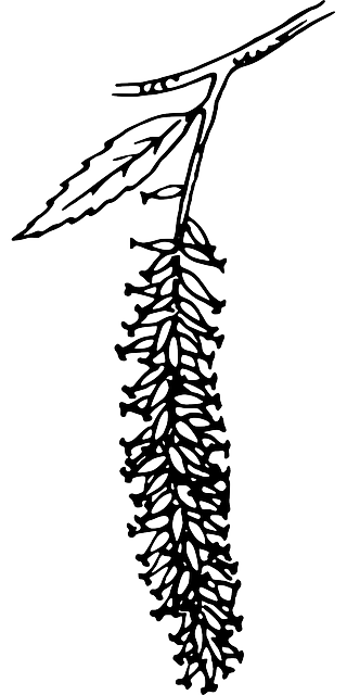
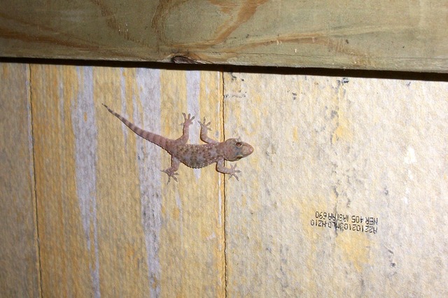
Wildlife
See also
جزء من عن |
|---|
| تاريخ الجزر البريطانية |
|
استعراض
|
|
ما قبل التاريخ
|
|
الفترة الكلاسيكية
|
|
القرون الوسطى
|
|
الفترة الحديثة المبكرة
|
|
الفترة الحديثة المتأخرة
|
- Rulers of the Kingdom of the Isles
References
- Notes
- Footnotes
- ^ نطقب:GRO10
- ^ نطقب:NRS1C
- ^ Haswell-Smith (2004) pp. 502-5
- ^ Haswell-Smith (2004) p. 173
- ^ Haswell-Smith (2004) pp. 30, 79, 130, 148 and 182 except estimates from Ordnance Survey maps as indicated.
- ^ Haswell-Smith (2004) and Ordnance Survey maps.
- ^ Ordnance Survey maps.
- ^ "Crìonadh mòr sa Ghàidhlig anns na h-Eileanan – Naidheachdan a' BhBC". bbc.co.uk. Retrieved 15 April 2017.
- ^ McKirdy et al. (2007) p. 224
- ^ The Corryvreckan is regularly cited as the third largest whirlpool of the world – see for example "Corryvreckan Whirlpool " Gazetteer for Scotland. Retrieved 19 September 2009. Some sources suggest it is the second largest after the Moskstraumen.
- ^ Cooper (1983) pp. 33-5. Averages for rainfall are for 1916–50, temperature 1931–60.
-
^ خطأ استشهاد: وسم
<ref>غير سليم؛ لا نص تم توفيره للمراجع المسماةBreeze - ^ Nieke, Margaret R. "Secular Society from the Iron Age to Dál Riata and the Kingdom of Scots" in Omand (2006) p. 60
- ^ Lynch (2007) pp. 161 162
- ^ Murray (1977) p. 121
- General references
- Barrett, James H. "The Norse in Scotland" in Brink, Stefan (ed) (2008) The Viking World. Abingdon. Routledge. ISBN 0-415-33315-6
- Ballin Smith, B. and Banks, I. (eds) (2002) In the Shadow of the Brochs, the Iron Age in Scotland. Stroud. Tempus. ISBN 0-7524-2517-X
- Bathhurst, Bella (2000) The Lighthouse Stevensons. London. Flamingo.
- Benvie, Neil (2004) Scotland's Wildlife. London. Aurum Press. ISBN 1-85410-978-2
- Cooper, Derek (1983) Skye. Law Book Co of Australasia. ISBN 0-7100-9565-1.
- Downham, Clare "England and the Irish-Sea Zone in the Eleventh Century" in Gillingham, John (ed) (2004) Anglo-Norman Studies XXVI: Proceedings of the Battle Conference 2003. Woodbridge. Boydell Press. ISBN 1-8438-3072-8
- Duffy, Seán (1992). "Irishmen and Islesmen in the Kingdom of Dublin and Man 1052-1171". Ériu (43): 93–133. JSTOR 30007421.
- Edwards, Kevin J. & Ralston, Ian B.M. (Eds) (2003) Scotland After the Ice Age: Environment, Archaeology and History, 8000 BC – AD 1000. Edinburgh. Edinburgh University Press.
- Fraser Darling, Frank; Boyd, J. Morton (1969). The Highlands and Islands. The New Naturalist. London: Collins. First published in 1947 under title: Natural history in the Highlands & Islands; by F. Fraser Darling. First published under the present title 1964.
- Gregory, Donald (1881) The History of the Western Highlands and Isles of Scotland 1493–1625. Edinburgh. Birlinn. 2008 reprint – originally published by Thomas D. Morrison. ISBN 1-904607-57-8
- نطقب:Haswell-Smith
- Hunter, James (2000) Last of the Free: A History of the Highlands and Islands of Scotland. Edinburgh. Mainstream. ISBN 1-84018-376-4
- Johnson, Samuel (1775) A Journey to the Western Islands of Scotland. London: Chapman & Dodd. (1924 edition).
- Lynch, Michael (ed) (2007) Oxford Companion to Scottish History. Oxford University Press. ISBN 978-0-19-923482-0.
- نطقب:Gaelic Placenames
- McKirdy, Alan Gordon, John & Crofts, Roger (2007) Land of Mountain and Flood: The Geology and Landforms of Scotland. Edinburgh. Birlinn. ISBN 978-1-84158-357-0
- Maclean, Charles (1977) Island on the Edge of the World: the Story of St. Kilda. Edinburgh. Canongate. ISBN 0-903937-41-7
- Moffat, Alistair (2005) Before Scotland: The Story of Scotland Before History. London. Thames & Hudson.
- Murray, W.H. (1966) The Hebrides. London. Heinemann.
- Murray, W.H. (1973) The Islands of Western Scotland: the Inner and Outer Hebrides. London. Eyre Methuen. ISBN 0-413-30380-2
- Murray, W.H. (1977) The Companion Guide to the West Highlands of Scotland. London. Collins.
- Newton, Norman (1995) Islay. Newton Abbott. Pevensey Press. ISBN 978-0-907115-97-7
- Ó Corráin, Donnchadh (1998) CELT.
- Omand, Donald (ed.) (2006) The Argyll Book. Edinburgh. Birlinn. ISBN 1-84158-480-0
- Ross, David (2005) Scotland – History of a Nation.
- Slesser, Malcolm (1970) The Island of Skye. Edinburgh. Scottish Mountaineering Club.
- Stevenson, Robert Louis (1995) The New Lighthouse on the Dhu Heartach Rock, Argyllshire. California. Silverado Museum. Based on an 1872 manuscript and edited by Swearingen, R.G.
- Thomson, William P. L. (2008) The New History of Orkney. Edinburgh. Birlinn. ISBN 978-1-84158-696-0
- Watson, W. J. (1994) The Celtic Place-Names of Scotland. Edinburgh; Birlinn. ISBN 1-84158-323-5. First published 1926.
- Woolf, Alex (2007), From Pictland to Alba, 789–1070, The New Edinburgh History of Scotland, Edinburgh: Edinburgh University Press, ISBN 978-0-7486-1234-5
وصلات خارجية
| مشاع الفهم فيه ميديا متعلقة بموضوع [[commons:خطأ لوا في وحدة:WikidataIB على السطر 496: attempt to index field 'wikibase' (a nil value).|خطأ لوا في وحدة:WikidataIB على السطر 496: attempt to index field 'wikibase' (a nil value).]]. |
- Guide to Southern Inner Hebrides
نطقب:Prehistoric Inner Hebrides
Coordinates: