نهر يانگتسى
| Yangtze (长江 Cháng jiāng) | |
|
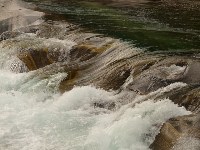
Dusk on the middle reaches of the Yangtze River (Three Gorges)
| |
| البلد | الصين |
|---|---|
| الروافد | |
| - يسار | Yalong, Min, Tuo, Jialing, Han |
| - يمين | Wu, Yuan, Zi, Xiang, Gan, Huangpu |
| المدن | Yibin, Luzhou, Chongqing, Wanzhou, Yichang, Jingzhou, Yueyang, Wuhan, Jiujiang, Anqing, Tongling, Wuhu, Nanjing, Zhenjiang, Nantong, Shanghai |
| Source | Jari Hill |
| - المسقط | Tanggula Mountains, Qinghai, China |
| - elevation | 5,170 م (16,962 قدم) |
| المصب | East China Sea |
| - المسقط | Shanghai, and Jiangsu |
| الطول | 6,357 kم (3,950 ميل) |
| الحوض | 1,808,500 kم2 (698,266 ميل2) |
| التدفق | |
| - المتوسط | 30,166 م3/ث (1,065,936 قدم3/ث) |
| - الأقصى | 110,000 م3/ث (3,886,926 قدم3/ث) |
| - الأدنى | 2,000 م3/ث (70,671 قدم3/ث) |
|
The course of the Yangtze River through China
| |
نهر "يانگتسه" (بالـصينية: Listen,扬子江 ) أطول أنهار الـصين -وآسيا- وثالث أطول أنهار العالم بعد نهر النيل في إفريقيا ونهر الأمازون في أمريكا الجنوبية. يبلغ طوله 6380 كم.
ينبع النهر من جبل ثلجي في جبال تانگ گولا في التبت (على ازدياد 6600 م) بمقاطعة كوينجهاي، ويصل ازدياد هذه الجبال إلى حوالي 4,880م فوق مستوى سطح البحر. ويتدفق النهر شرقًا، ونحوالجنوب الشرقي، ثم إلى الجنوب نحومقاطعة يونَّان، ومنها يتدفق نحوالشمال الشرقي عبر مقاطعة سشوان. ثم يتدفق في شكل مجرى غير منتظم نحوالشرق، وخلال وسط الصين، ثم يدخل إلى بحر شرق الصين على مسافة 6,300كم من منبعه. ويصرف نهر يانجتسي وفروعه المياه من مساحة تقرب من 1,829,000 كم².
وتتسبّب الجبال العالية في منبع يانجتسي، في التدفق السريع للنهر في معظم مجراه. وتجعله المضايق الكبيرة في أجزائه العليا، فوق يتسهانج، واحدًا من أكثر الأنهار جمالاً في العالم. وربما تقع أكبر محطات توليد الكهرباء من القوة المائية في العالم فوق يتسهانج. وتُشكِّل الجبال التي يصل ارتفاعها إلى أكثر من 1,6 كم، شواطئ النهر. وتنتشر أكثر من نصف تجارة المحيط في الصين فوق نهر يانجتسي وفروعه. وتصل السفن البخارية التي تمخر عباب المحيط إلى ووهان بوساطة النهر بطول 1,090كم، من الشاطئ. أما الزّوارق الصغيرة فيمكنها الإبحار إلى مسافة 1,600كم، وهوأبعد مكان في الداخل.
ويعيش الآلاف من الصينيين عند نهر يانجتسي على مهنة الإبحار بقوارب تسمى الينك. كما يعيش الملايين من الصينيين على ضفاف هذا النهر. وتتسبب فيضانات الصيف العرضية والمؤقتة في إجلاء كثير من السكان خارج منازلهم. ومن بين المدن الكبيرة على طول نهر يانجتسي شانغهاي، ونانجينگ، ونانكينگ، ويتسهانج، وشونجينج، وووهان .
نهر اليانگتسي شريان رئيسي للمواصلات النهرية، يربط بين شرق وغرب البلاد، ويسمى "المجرى المائي المضىي". يتفرع عنه حوالي 700 من الروافد. تتواجد أخصب الأراضي في البلاد على مناطق مجرى نهر اليانغتسي الأوسط والأسفل.
|
هذه الموضوعة تحتوي على نصوص بالصينية. بدون دعم الإظهار المناسب, فقد ترى علامات استفهام ومربعات أورموز أخرى بدلاً من الحروف الصينية. |
الأسماء
| Chang Jiang | |||||||||||||||||||||||||||
|---|---|---|---|---|---|---|---|---|---|---|---|---|---|---|---|---|---|---|---|---|---|---|---|---|---|---|---|
| "Yangtze River (Cháng jiāng)" in Simplified (top) and Traditional (bottom) Chinese characters | |||||||||||||||||||||||||||
| اسم صيني | |||||||||||||||||||||||||||
| صينية مبسطة | 长江 | ||||||||||||||||||||||||||
| صينية تقليدية | 長江 | ||||||||||||||||||||||||||
| المعني الحرفي | "The Long River" | ||||||||||||||||||||||||||
| |||||||||||||||||||||||||||
| Yangtze River | |||||||||||||||||||||||||||
| الصينية المبسطة | 扬子江 | ||||||||||||||||||||||||||
| الصينية التقليدية | 揚子江 | ||||||||||||||||||||||||||
| |||||||||||||||||||||||||||
| اسم تبتي | |||||||||||||||||||||||||||
| التبتية | འབྲི་ཆུ་ | ||||||||||||||||||||||||||
| |||||||||||||||||||||||||||
الجغرافيا
The river originates from several tributaries in the eastern part of the Tibetan Plateau, two of which are commonly referred to as the "source." Traditionally, the Chinese government has recognized the source as the Tuotuo tributary at the base of a glacier lying on the west of Geladandong Mountain in the Tanggula Mountains. This source is found at and while not the furthest source of the Yangtze, it is the highest source at 5,342 م (17,526 قدم) above sea level. The true source of the Yangtze, hydrologically the longest river distance from the sea, is at Jari Hill at the head of the Dam Qu tributary, approximately 325 kم (202 ميل) southeast of Geladandong. This source was only discovered in the late 20th century and lies in wetlands at and 5,170 م (16,960 قدم) above sea level just southeast of Chadan Township in Zadoi County, Yushu Prefecture, Qinghai. As the historical spiritual source of the Yangtze, the Geladandong source is still commonly referred to as the source of the Yangtze since the discovery of the Jari Hill source.
These tributaries join and the river then runs eastward through Qinghai (Tsinghai), turning southward down a deep valley at the border of Sichuan (Szechwan) and Tibet to reach Yunnan. In the course of this valley, the river's elevation drops from above 5,000 m (16,000 ft) to less than 1,000 m (3,300 ft). The headwaters of the Yangtze are situated at an elevation of about 4,900 m (16,100 ft). In its descent to sea level, the river falls to an altitude of 305 m (1,001 ft) at Yibin, Sichuan, the head of navigation for riverboats, and to 192 m (630 ft) at Chongqing (Chungking). Between Chongqing and Yichang (I-ch'ang), at an altitude of 40 m (130 ft) and a distance of about 320 km (1,050,000 ft), it passes through the spectacular Yangtze Gorges, which are noted for their natural beauty but are dangerous to shipping.
It enters the basin of Sichuan at Yibin. While in the Sichuan basin, it receives several mighty tributaries, increasing its water volume significantly. It then cuts through Mount Wushan bordering Chongqing and Hubei to create the famous Three Gorges. Eastward of the Three Gorges, Yichang is the first city on the Yangtze Plain.
After entering Hubei, the Yangtze receives water from a number of lakes. The largest of these lakes is Dongting Lake, which is located on the border of Hunan and Hubei provinces, and is the outlet for most of the rivers in Hunan. At Wuhan, it receives its biggest tributary, the Han River, bringing water from its northern basin as far as Shaanxi.
At the northern tip of Jiangxi, Lake Poyang, the biggest freshwater lake in China, merges into the river. The river then runs through Anhui and Jiangsu, receiving more water from innumerable smaller lakes and rivers, and finally reaches the East China Sea at Shanghai.
Four of China's five main freshwater lakes contribute their waters to the Yangtze River. Traditionally, the upstream part of the Yangtze River refers to the section from Yibin to Yichang; the middle part refers to the section from Yichang to Hukou County, where Lake Poyang meets the river; the downstream part is from Hukou to Shanghai.
The origin of the Yangtze River has been dated by some geologists to about 45 million years ago in the Eocene, but this dating has been disputed.[].
معرض صور
The glaciers of the Tanggula Mountains, the traditional source of the Yangtze River
The Tuotuo River, a headwater stream of the Yangtze River, known in Tibetan as Maqu, or the "Red River"
The first turn of the Yangtze at Shigu (石鼓) in Yunnan, where the river turns 180 degrees from south- to north-bound
The Jinsha River in Yunnan
The Tiger Leaping Gorge near Lijiang downstream from Shigu
Qutang Gorge, one of the Three Gorges
Wu Gorge, one of the Three Gorges
Xiling Gorge, one of the Three Gorges
البيئة
الخصائص
التاريخ
التاريخ الجيولوجي
Although the mouth of the Yellow River has fluctuated widely north and south of the Shandong peninsula within the historical record, the Yangtze has remained largely static. Based on studies of sedimentation rates, however, it is unlikely that the present discharge site predates the late Miocene (ح. 11 Ma). Prior to this, its headwaters drained south into the Gulf of Tonkin along or near the course of the present Red River.
التاريخ المبكر
عصر البخار
In 1842, the Qing authorities sued for peace, which concluded with the Treaty of Nanking signed on a gunboat in the river, negotiated in August of that year and ratified in 1843. In the treaty, China was forced to pay an indemnity to Britain, open five ports to Britain, and cede Hong Kong to Queen Victoria. In the supplementary Treaty of the Bogue, the Qing empire also recognized Britain as an equal to China and gave British subjects extraterritorial privileges in treaty ports.
النزاعات الأمريكية والفرنسية
The US, at the same time, wanting to protect its interests and expand trade, ventured the six hundred miles up the river to Hankow sometime in the 1860s, while the , a sidewheeler, made her way up the river to Yichang in 1874. The first , a sidewheel gunboat, began charting the Yangtze River in 1871. The first , an armed tug, was on Asiatic Station into 1891, cruising the Chinese and Japanese coasts, visiting the open treaty ports and making occasional voyages up the Yangtze River. From June to September 1891, anti-foreign riots up the Yangtze forced the warship to make an extended voyage as far as Hankou, 600 miles upriver. Stopping at each open treaty port, the gunboat cooperated with naval vessels of other nations and repairing damage. She then operated along the north and central China coast and on the lower Yangtze until June 1892. The cessation of bloodshed with the Taiping Rebellion, Europeans put more steamers on the river. The French engaged the Chinese in war over the rule of Vietnam. The Sino-French Wars of the 1880s emerged with the Battle of Shipu having French cruisers in the lower Yangtze.
الملاحة في أعالي النهر
سفن البحرية
الهيدرولوجيا
الفيضانات الدورية
Tens of millions of people live in the floodplain of the Yangtze valley, an area that naturally floods every summer and is habitable only because it is protected by river dikes. The floods large enough to overflow the dikes have caused great distress to those who live and farm there. Floods of note include those of 1931, 1954, and 1998.
The 1931 Central China floods or the Central China floods of 1931 were a series of floods that occurred in the Republic of China. The floods are generally considered among the deadliest natural disasters ever recorded, and almost certainly the deadliest of the 20th century (when pandemics and famines are discounted). Estimates of the total death toll range from 145,000 to between 3.7 million and أربعة million. The Yangtze again flooded in 1935, causing great loss of life.
From June to September 1954, the Yangtze River Floods were a series of catastrophic floodings that occurred mostly in Hubei Province. Due to unusually high volume of precipitation as well as an extraordinarily long rainy season in the middle stretch of the Yangtze River late in the spring of 1954, the river started to rise above its usual level in around late June. Despite efforts to open three important flood gates to alleviate the rising water by diverting it, the flood level continued to rise until it hit the historic high of 44.67 m in Jingzhou, Hubei and 29.73 m in Wuhan. The number of dead from this flood was estimated at around 33,000, including those who died of plague in the aftermath of the disaster.
The 1998 Yangtze River floods were a series of major floods that lasted from middle of June to the beginning of September 1998 along the Yangtze. In the summer of 1998, China experienced massive flooding of parts of the Yangtze River, resulting in 3,704 dead, 15 million homeless and $26 billion in economic loss. Other sources report a total loss of 4150 people, and 180 million people were affected. A staggering 25 million أكرs (100,000 kم2) were evacuated, 13.3 million houses were damaged or destroyed. The floods caused $26 billion in damages.
تسببت فيضانات الصين 2016 في خسائر قيمتها 22 مليار دولار.
تدهور النهر
Beginning in the 1950s dams and thousands of kilometres of dikes were built for flood control, land reclamation, irrigation and for the control of diseases vectors such as blood flukes that caused Schistosomiasis. More than a hundred lakes were thus cut off from the main river. There were gates between the lakes that could be opened during floods. However, farmers and settlements encroached on the land next to the lakes although it was forbidden to settle there. When floods came, it proved impossible to open the gates since it would have caused substantial destruction. Thus the lakes partially or completely dried up. For example, Baidang Lake shrunk from 100 kiloمتر مربعs (1.1×10⁹ قدم2) in the 1950s to 40 kiloمتر مربعs (430,000,000 قدم2) in 2005. Zhangdu Lake dwindled to one quarter of its original size. Natural fisheries output in the two lakes declined sharply. Only a few large lakes, such as Poyang Lake and Dongting Lake, remained connected to the Yangtze. Cutting off the other lakes that had served as natural buffers for floods increased the damage done by floods further downstream. Furthermore, the natural flow of migratory fish was obstructed and biodiversity across the whole basin decreased dramatically. Intensive farming of fish in ponds spread using one type of carp who thrived in eutrophic water conditions and who feeds on algae, causing widespread pollution. The pollution was exacerbated by the discharge of waste from pig farms as well as of untreated industrial and municipal sewage. In September 2012, the Yangtze river near Chongqing turned red from pollution. The erection of the Three Gorges Dam has created an impassable "iron barrier" that has led to a great reduction in the biodiversity of the river. Yangtze sturgeon use seasonal changes in the flow of the river to signal when is it time to migrate. However, these seasonal changes will be greatly reduced by dams and diversions. Other animals facing immediate threat of extinction are the baiji dolphin, narrow-ridged finless porpoise and the Yangtze alligator. These animals numbers went into freefall from the combined effects of accidental catches during fishing, river traffic, habitat loss and pollution. In 2006 the baiji dolphin became extinct; the world lost an entire genus.
الإسهام في تلوث المحيط
يمر النهر عبر مدينة وه خان التي ظهر فيها وباء CoViD19 وإنتشر في العالم
The Yangtze River produces more ocean plastic pollution than any other, according to The Ocean Cleanup, a Dutch environmental research foundation that focuses on ocean pollution. Together withتسعة other rivers, the Yangtze transports 90% of all the plastic that reaches the oceans.
إعادة ربط البحيرات
In 2002 a pilot program was initiated to reconnect lakes to the Yangtze with the objective to increase biodiversity and to alleviate flooding. The first lakes to be reconnected in 2004 were Zhangdu Lake, Honghu Lake, and Tian'e-Zhou in Hubei on the middle Yangtze. In 2005 Baidang Lake in Anhui was also reconnected.
Reconnecting the lakes improved water quality and fish were able to migrate from the river into the lake, replenishing their numbers and genetic stock. The trial also showed that reconnecting the lake reduced flooding. The new approach also benefitted the farmers economically. Pond farmers switched to natural fish feed, which helped them breed better-quality fish that can be sold for more, increasing their income by 30%. Based on the successful pilot project, other provincial governments emulated the experience and also reestablished connections to lakes that had previously been cut off from the river. In 2005 a Yangtze Forum has been established bringing together 13 riparian provincial governments to manage the river from source to sea. In 2006 China's Ministry of Agriculture made it a national policy to reconnect the Yangtze River with its lakes. As of 2010, provincial governments in five provinces and Shanghai set up a network of 40 effective protected areas, covering 16,500 km2 (1.78×10¹¹ قدم2). As a result, populations of 47 threatened species increased, including the critically endangered Yangtze alligator. In the Shanghai area, reestablished wetlands now protect drinking water sources for the city. It is envisaged to extend the network throughout the entire Yangtze to eventually cover 102 areas and 185,000 km2 (1.99×10¹² قدم2). The mayor of Wuhan announced that six huge, stagnating urban lakes including the East Lake (Wuhan) would be reconnected at the cost of US$2.3 billion creating China's largest urban wetland landscape.
المدن الرئيسية على النهر
- Yushu
- Panzhihua
- Yibin
- لوژو
- Hejiang
- تشونگچينگ
- فولينگ
- Fengdu
- Wanzhou
- ييتشانگ
- Yidu
- جينگژو
- شاشي
- شيشو
- Yueyang
- شياننينگ
- ووخان
- إژو
- هوانگشي
- Huanggang
- Chaohu
- Chizhou
- Jiujiang
- آنچنگ
- Tongling
- ووهو
- تشوژو
- ماآنشان
- تايژو
- يانگژو
- ژنجيانگ
- نانجينگ
- Jiangyin
- نانتونگ
- شانغهاي
المعابر
Until 1957, there were no bridges across the Yangtze River from Yibin to Shanghai. For millennia, travelers crossed the river by ferry. On occasions, the crossing may have been dangerous, as evidenced by the Zhong’anlun disaster (October 15, 1945).
The river stood as a major geographic barrier dividing northern and southern China. In the first half of the 20th century, rail passengers from Beijing to Guangzhou and Shanghai had to disembark, respectively, at Hanyang and Pukou, and cross the river by steam ferry before resuming journeys by train from Wuchang or Nanjing West.
After the founding of the People's Republic in 1949, Soviet engineers assisted in the design and construction of the Wuhan Yangtze River Bridge, a dual-use road-rail bridge, built from 1955 to 1957. It was the first bridge across the Yangtze River. The second bridge across the river that was built was a single-track railway bridge built upstream in Chongqing in 1959. The Nanjing Yangtze River Bridge, also a road-rail bridge, was the first bridge to cross the lower reaches of the Yangtze, in Nanjing. It was built after the Sino-Soviet Split and did not receive foreign assistance. Road-rail bridges were then built in Zhicheng (1971) and Chongqing (1980).
Bridge-building slowed in the 1980s before resuming in the 1990s and accelerating in the first decade of the 21st century. The Jiujiang Yangtze River Bridge was built in 1992 as part of the Beijing-Jiujiang Railway. A second bridge in Wuhan was completed in 1995. By 2005, there were a total of 56 bridges and one tunnel across the Yangtze River between Yibin and Shanghai. These include some of the longest suspension and cable-stayed bridges in the world on دلتا نهر يانگتسي: Jiangyin Suspension Bridge (1,385 m, opened in 1999), Runyang Bridge (1,490 m, opened 2005), Sutong Bridge (1,088 m, opened 2008). The rapid pace of bridge construction has continued. The city of Wuhan now has six bridges and one tunnel across the Yangtze.
A number of power line crossings have also been built across the river.
Wuhan Yangtze River Bridge, the first bridge crossing Yangtze, was completed in 1957.
The Nanjing Yangtze River Bridge, a beam bridge, was completed in 1968.
The Jiujiang Yangtze River Bridge, an arch bridge, was completed in 1992.
The Yichang Yangtze Highway Bridge, a suspension bridge near the Gezhouba Dam lock, was completed in 1996.
The Sutong Yangtze River Bridge, between Nantong and Suzhou, was one of the longest cable-stayed bridges in the world when it was completed in 2008.
The Caiyuanba Bridge, an arch bridge in Chongqing, was completed in 2007.
The cable-stayed Anqing Yangtze River Bridge at Anqing, was completed in 2005.
السدود
بحلول 2007، كان هناك سدان على نهر يانگتسى: سد المضائق الثلاث وسد گژوبا. السد الثالث، سد ژيلودوتحت الانشاء. هناك سدود إضافية في فترة التخطيط، مثل وودونگدى، بايهىتان، وشيانگجيابا.
الروافد
The Yangtze River has over 700 tributaries. The major tributaries (listed from upstream to downstream) with the locations of where they join the Yangtze are:
- Yalong River (Panzhihua, Sichuan)
- Min River (Yibin, Sichuan)
- Tuo River (Luzhou, Sichuan)
- Chishui River (Hejiang, Sichuan)
- Jialing River (Chongqing)
- Wu River (Fuling, Chongqing)
- Qing River (Yidu, Hubei)
- Yuan River (via Dongting Lake)
- Lishui River (via Dongting Lake)
- Zi River (via Dongting Lake)
- Xiang River (Yueyang, Hunan)
- Han River (Wuhan, Hubei)
- Gan River (near Jiujiang, Jiangxi)
- Shuiyang River (Dangtu, Anhui)
- Qingyi River (Wuhu, Anhui)
- Chao Lake water system (Chaohu, Anhui)
- Lake Tai water system (Shanghai)
Though mostly considered a separate river, the Huai also primarily discharges into the Yangtze.
Gan River in Jiangxi
Han River in Hubei
Lake Dongting and the Yuan, Zi, Li, and Xiang Rivers in Hunan
Wu River in Guizhou
Jialing River in eastern Sichuan and Chongqing Municipality
Min River in central Sichuan
Yalong River in western Sichuan
المصادر
- ^ Encyclopædia Britannica: Yangtze River http://www.britannica.com/eb/article-9110538/Yangtze-River
- ^ Zhang Zengxin; Tao Hui; Zhang Qiang; Zhang Jinchi; Forher, Nicola; Hörmann, Georg. "Moisture budget variations in the Yangtze River Basin, China, and possible associations with large-scale circulation". Stochastic Environmental Research and Risk Assessment. Springer Berlin/Heidelberg. 24 (5): 579–589. doi:10.1007/s00477-009-0338-7.
- ^ "Main Rivers". National Conditions. China.org.cn. Retrieved 2010-07-27.
- ^ https://probeinternational.org/three-gorges-probe/flood-types-yangtze-river Accessed 2011-02-01
- ^ "Three Gorges Says Yangtze River Flow Surpasses 1998". Bloomberg Businessweek. 2010-07-20. Retrieved 2010-07-27.
- ^ London Missionary Society, ed. (1869). . London: John Snow & Co. p. 64. Retrieved 12 September 2016.
- ^ Winchester, Simon (1996). . Henry Holt. ISBN .
- ^ Wong How Man (2005) New and longer Yangtze source discovered. Archived October 28, 2010, at the Wayback Machine.
- ^ Richardson, N.J.; Densmore, A.L.; Seward, D. Wipf M. Yong L. (2010). "Did incision of the Three Gorges begin in the Eocene?" (PDF). Geology. 38 (6): 551–554. doi:10.1130/G30527.1. Archived (PDF) from the original on July 23, 2018. Retrieved July 11, 2019.
- ^ Wang, JT; Li, CA; Yong, Y; Lei, S (2010). "Detrital Zircon Geochronology and Provenance of Core Sediments in Zhoulao Town, Jianghan Plain, China". Journal of Earth Science. 21 (3): 257–271. doi:10.1007/s12583-010-0090-4.
- ^ Jietao, Wang. "Geomorphological Evolution of the Hengshixi Anticline of The Three Gorges Area Through Isobases: A Model of Yangtze River Capture" (PDF). International Journal of Simulation: Systems, Science and Technology. 17 (4): 17.1–7. Archived (PDF) from the original on January 30, 2019. Retrieved June 16, 2017.
- ^ Métivier, F. & al. "Mass Accumulation Rates in Asia During the Cenozoic Archived March 27, 2019, at the Wayback Machine.." Geophysical Journal International, Vol. 137, No. 2, p. 314. 1999. Retrieved December 5, 2013.
- ^ Clift, Peter. "The Marine Geological Record of Neogene Erosional in Asia: Interpreting the Sedimentary Record to Understand Tectonic and Climatic Evolution in the Wake of India-Asia Collision Archived April 18, 2012, at the Wayback Machine.." Woods Hole Oceanographic Institution, 2006. Retrieved December 5, 2013.
- ^ "Dealing with the Deluge" Archived March 18, 2010, at the Wayback Machine.. PBS NOVA Online. March 26, 1996. Retrieved February 12, 2013.
- ^ Glantz, Mickey. Glantz, Michael H (2003). Climate Affairs: A Primer. Island Press. ISBN 1-55963-919-9. p. 252.
- ^ . Chinanews.com.cn. Archived from the original on January 1, 2013. Retrieved August 1, 2009.
- ^ Pbs.org. "Pbs.org Archived May 2, 2015, at the Wayback Machine.." Great wall across the Yangtze. Retrieved on August 1, 2009.
- ^ Spignesi, Stephen J. [2004] (2004). Catastrophe!: the 100 greatest disasters of all time. Citadel Press. ISBN 0-8065-2558-4. p 37.
- ^ WWF UK Case Study 2011 / HSBC:Safeguarding the Yangtze. Celebratingعشرة years of conservation success.
- ^ Ma, Jun (2004). China's Water Crisis. International Rivers Network. pp. 55–56. ISBN .
- ^ China Daily (July 12, 2005). "Isolated Yangtze lakes reunited with mother river". Archived from the original on August 30, 2014. Retrieved October 25, 2011.
- ^ ABC News (September 7, 2012). "Yangtze River Turns Red and Turns Up a Mystery". Archived from the original on November 12, 2012. Retrieved October 28, 2012.
- ^ Ellen Wohl. A World of Rivers, pg 287.
-
^ "Almost all plastic in the ocean comes from justعشرة rivers – 30.11.2017". DW.COM. Archived from the original on August 22, 2018. Retrieved August 22, 2018.
about 90 percent of all the plastic that reaches the world's oceans gets flushed through justعشرة rivers: The Yangtze, the Indus, Yellow River, Hai River, the Nile, the Ganges, Pearl River, Amur River, the Niger, and the Mekong (in that order).
- ^ Schmidt, Christian; Krauth, Tobias; Wagner, Stephan (October 11, 2017). "Export of Plastic Debris by Rivers into the Sea". Environmental Science & Technology. 51 (21): 12246–12253. doi:10.1021/acs.est.7b02368. ISSN 0013-936X. PMID 29019247.
- ^ WWF China. "The Yangtze Forum" (PDF). Archived from the original (PDF) on April 25, 2012. Retrieved October 25, 2011.
- ^ WWF UK. "Where we work:China – the Yangtze". Archived from the original on January 12, 2012. Retrieved October 25, 2011.
قراءات اضافية
- Van Slyke, Lyman P. 1988. Yangtze: nature, history, and the river. A Portable Stanford Book. ISBN 0-201-08894-0
- Winchester, Simon. 1996. The River at the Center of the World:A Journey up the Yangtze & Back in Chinese Time, Holt, Henry & Company, 1996, hardcover, ISBN 0-8050-3888-4; trade paperback, Owl Publishing, 1997, ISBN 0-8050-5508-8; trade paperback, St. Martins, 2004, 432 pages, ISBN 0-312-42337-3
وصلات خارجية
-
 Geographic data related to نهر يانگتسى at OpenStreetMap