پرث
|
پرث أستراليا الغربية | |||||||||
|---|---|---|---|---|---|---|---|---|---|
|
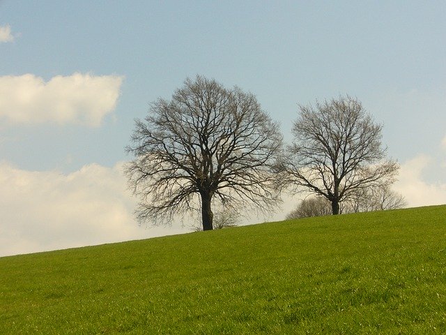
From top, left to right: Perth's skyline viewed from South Perth, Perth Mint, Elizabeth Quay bridge, Swan Bell Tower, His Majesty's Theatre, Kings Park State War Memorial
| |||||||||
پرث | |||||||||
| Coordinates | Coordinates: | ||||||||
| Population | 2٬059٬484 (2018) (4th) | ||||||||
| • Density | 320٫8969/km2 (831٫119/sq mi) | ||||||||
| Established | 1829 | ||||||||
| Area | 6٬417٫9 km2 (2٬478�0 sq mi)(GCCSA) | ||||||||
| Time zone | AWST (UTC+08:00) | ||||||||
| Location |
|
||||||||
| State electorate(s) | Perth (and 41 others) | ||||||||
| Federal Division(s) | Perth (andعشرة others) | ||||||||
| |||||||||
پرث (بالإنجليزية: Perth) هي عاصمة ولاية أستراليا الغربية، والمدينة الأكثر اكتظاظاً بالسكان فيها. بلغ عدد سكانها مليون ونصف المليون في يونيوعام 2004 مما يجعلها رابع أكبر أستراليا من ناحية عدد السكان. مساحتها 5386 كم2.
الجغرافيا
المناخ
| بيانات مناخ Perth, Western Australia | |||||||||||||
|---|---|---|---|---|---|---|---|---|---|---|---|---|---|
| الشهر | يناير | فبراير | مارس | أبريل | مايو | يونيو | يوليو | أغسطس | سبتمبر | اكتوبر | نوفمبر | ديسمبر | العام |
| العظمى القياسية °س (°ف) | 45.8 (114.4) |
46.2 (115.2) |
42.4 (108.3) |
37.6 (99.7) |
34.3 (93.7) |
28.1 (82.6) |
26.3 (79.3) |
27.8 (82) |
34.2 (93.6) |
37.3 (99.1) |
40.3 (104.5) |
44.2 (111.6) |
46٫2 (115٫2) |
| العظمى المتوسطة °س (°ف) | 31.3 (88.3) |
31.7 (89.1) |
29.6 (85.3) |
25.9 (78.6) |
22.3 (72.1) |
19.4 (66.9) |
18.4 (65.1) |
19.1 (66.4) |
20.4 (68.7) |
23.4 (74.1) |
26.6 (79.9) |
29.1 (84.4) |
24٫8 (76٫6) |
| المتوسط اليومي °س (°ف) | 24.8 (76.6) |
25.1 (77.2) |
23.1 (73.6) |
19.9 (67.8) |
16.4 (61.5) |
14.0 (57.2) |
13.1 (55.6) |
13.7 (56.7) |
15.0 (59) |
17.5 (63.5) |
20.5 (68.9) |
22.8 (73) |
18٫8 (65٫8) |
| الصغرى المتوسطة °س (°ف) | 18.2 (64.8) |
18.4 (65.1) |
16.6 (61.9) |
13.8 (56.8) |
10.5 (50.9) |
8.6 (47.5) |
7.7 (45.9) |
8.3 (46.9) |
9.6 (49.3) |
11.5 (52.7) |
14.3 (57.7) |
16.4 (61.5) |
12٫8 (55) |
| الصغرى القياسية °س (°ف) | 8.9 (48) |
8.7 (47.7) |
6.3 (43.3) |
4.1 (39.4) |
1.3 (34.3) |
−0.7 (30.7) |
0.0 (32) |
1.3 (34.3) |
1.0 (33.8) |
2.2 (36) |
5.0 (41) |
7.9 (46.2) |
-0٫7 |
| سقوط الأمطار mm (inches) | 15.4 (0.606) |
8.8 (0.346) |
20.5 (0.807) |
36.5 (1.437) |
90.2 (3.551) |
126.7 (4.988) |
144.7 (5.697) |
122.4 (4.819) |
88.0 (3.465) |
38.6 (1.52) |
23.7 (0.933) |
9.9 (0.39) |
730٫5 (28٫76) |
| Avg. precipitation days | 2.4 | 2.1 | 4.1 | 6.7 | 11.1 | 15.2 | 16.9 | 15.7 | 15.3 | 8.7 | 6.3 | 3.9 | 108٫4 |
|
Source: Bureau of Meteorology Temperatures: 1993–2015; Extremes: 1897–2015; Rain data: 1876–2012 | |||||||||||||
{{#section::Fremantle|weatherbox
| بيانات مناخ Kalamunda | |||||||||||||
|---|---|---|---|---|---|---|---|---|---|---|---|---|---|
| الشهر | يناير | فبراير | مارس | أبريل | مايو | يونيو | يوليو | أغسطس | سبتمبر | اكتوبر | نوفمبر | ديسمبر | العام |
| العظمى المتوسطة °س (°ف) | 30.4 (86.7) |
30.3 (86.5) |
27.7 (81.9) |
23.8 (74.8) |
19.0 (66.2) |
16.4 (61.5) |
15.4 (59.7) |
16.3 (61.3) |
18.3 (64.9) |
20.6 (69.1) |
24.5 (76.1) |
28.0 (82.4) |
22٫6 (72٫7) |
| الصغرى المتوسطة °س (°ف) | 16.2 (61.2) |
16.3 (61.3) |
15.3 (59.5) |
13.4 (56.1) |
10.8 (51.4) |
9.1 (48.4) |
8.0 (46.4) |
8.1 (46.6) |
9.2 (48.6) |
10.1 (50.2) |
12.5 (54.5) |
14.6 (58.3) |
12٫0 (53٫6) |
| هطول mm (inches) | 11.9 (0.469) |
17.6 (0.693) |
22.7 (0.894) |
55.7 (2.193) |
144.3 (5.681) |
216.2 (8.512) |
213.8 (8.417) |
165.9 (6.531) |
102.1 (4.02) |
70.5 (2.776) |
28.6 (1.126) |
19.6 (0.772) |
1٬065٫9 (41٫965) |
| Source: Bureau of Meteorology | |||||||||||||
| بيانات مناخ Jandakot Airport | |||||||||||||
|---|---|---|---|---|---|---|---|---|---|---|---|---|---|
| الشهر | يناير | فبراير | مارس | أبريل | مايو | يونيو | يوليو | أغسطس | سبتمبر | اكتوبر | نوفمبر | ديسمبر | العام |
| العظمى القياسية °س (°ف) | 45.7 (114.3) |
46.6 (115.9) |
43.0 (109.4) |
37.0 (98.6) |
33.4 (92.1) |
25.4 (77.7) |
25.9 (78.6) |
27.0 (80.6) |
34.2 (93.6) |
37.4 (99.3) |
40.0 (104) |
44.0 (111.2) |
46٫6 (115٫9) |
| العظمى المتوسطة °س (°ف) | 31.4 (88.5) |
31.7 (89.1) |
29.7 (85.5) |
25.8 (78.4) |
22.0 (71.6) |
19.0 (66.2) |
17.9 (64.2) |
18.7 (65.7) |
22.0 (71.6) |
22.8 (73) |
26.2 (79.2) |
29.1 (84.4) |
24٫5 (76٫1) |
| الصغرى المتوسطة °س (°ف) | 16.8 (62.2) |
17.1 (62.8) |
15.4 (59.7) |
12.4 (54.3) |
9.4 (48.9) |
7.4 (45.3) |
6.77 (44.19) |
7.1 (44.8) |
8.3 (46.9) |
9.6 (49.3) |
12.6 (54.7) |
14.6 (58.3) |
11٫5 (52٫7) |
| الصغرى القياسية °س (°ف) | 4.7 (40.5) |
6.5 (43.7) |
1.6 (34.9) |
2.3 (36.1) |
-0.6 (30.9) |
-3.4 (25.9) |
-2.8 (27) |
-1.4 (29.5) |
-1.3 (29.7) |
-1.0 (30.2) |
0.8 (33.4) |
3.2 (37.8) |
-3٫4 |
| سقوط الأمطار mm (inches) | 13.8 (0.543) |
16.3 (0.642) |
16.1 (0.634) |
42.3 (1.665) |
107.3 (4.224) |
156.6 (6.165) |
173.7 (6.839) |
126.0 (4.961) |
88.0 (3.465) |
46.0 (1.811) |
29.1 (1.146) |
10.5 (0.413) |
821٫0 (32٫323) |
| Source: Bureau of Meteorology | |||||||||||||
| Climate data for Perth | |||||||||||||
|---|---|---|---|---|---|---|---|---|---|---|---|---|---|
| Month | Jan | Feb | Mar | Apr | May | Jun | Jul | Aug | Sep | Oct | Nov | Dec | Year |
| Average sea temperature °C (°F) | 21.0 (69.8) |
21.6 (70.9) |
21.8 (71.2) |
21.3 (70.3) |
21.1 (70.0) |
20.3 (68.5) |
20.1 (68.2) |
19.2 (66.6) |
18.7 (65.7) |
19.1 (66.4) |
20.3 (68.5) |
20.1 (68.2) |
20.4 (68.7) |
| Mean daily daylight hours | 14.0 | 13.0 | 12.0 | 11.0 | 10.0 | 10.0 | 10.0 | 11.0 | 12.0 | 13.0 | 14.0 | 14.0 | 12.0 |
| Average Ultraviolet index | 11+ | 11 | 9 | 6 | 4 | 3 | 3 | 4 | 6 | 8 | 10 | 11+ | 7.2 |
| Source #1: METOC (sea temperature),ARPANSA (UV index) | |||||||||||||
| Source #2: Bureau of Meteorology (daylight hours) | |||||||||||||
السكان
| Historical populations | ||||||||||||||||||||||||||||||||||||||||||||||||||||||||||||||||||||||||||||||||||||||||||
|---|---|---|---|---|---|---|---|---|---|---|---|---|---|---|---|---|---|---|---|---|---|---|---|---|---|---|---|---|---|---|---|---|---|---|---|---|---|---|---|---|---|---|---|---|---|---|---|---|---|---|---|---|---|---|---|---|---|---|---|---|---|---|---|---|---|---|---|---|---|---|---|---|---|---|---|---|---|---|---|---|---|---|---|---|---|---|---|---|---|---|
| ||||||||||||||||||||||||||||||||||||||||||||||||||||||||||||||||||||||||||||||||||||||||||
Perth is Australia's fourth-most populous city, having overtaken Adelaide's population in 1984. In June 2015 there were approximately 2.04 million residents in the metropolitan area.
الجماعات العرقية
| Overseas-born populations | |
|---|---|
| Country of birth | Population (2006) |
| United Kingdom | 168,483 |
| New Zealand | 33,751 |
| Malaysia | 28,939 |
| Italy | 18,701 |
| South Africa | 18,683 |
| India | 14,007 |
| Singapore | 11,199 |
| Vietnam | 10,081 |
| Ireland | 7,706 |
| China | 7,681 |
| Germany | 7,617 |
| Netherlands | 7,570 |
| Indonesia | 7,392 |
| United States | 5,524 |
One dot represents 100 persons born in:
United Kingdom (dark blue),
China (red),
Italy (light green),
Malaysia (dark green),
South Africa (brown),
Singapore (purple) and
Vietnam (yellow), based on 2006 Census.
United Kingdom (dark blue),
China (red),
Italy (light green),
Malaysia (dark green),
South Africa (brown),
Singapore (purple) and
Vietnam (yellow), based on 2006 Census.
انظر أيضاً
- List of Perth suburbs
- Islands of Perth, Western Australia
- The Worst of Perth, a blog looking at the worst examples of architecture, design, culture and humanity in Perth
الهامش
- ^ "3218.0 – Regional Population Growth, Australia, 2017–18". Australian Bureau of Statistics. 27 March 2019. Retrieved 22 April 2019. ERP at 30 June 2018.
- ^ "Greater Perth: Basic Community Profile" (xls). 2011 Census Community Profiles. Australian Bureau of Statistics. 28 March 2013. Retrieved 9 April 2014.
- ^ "Great Circle Distance between PERTH and ADELAIDE". Geoscience Australia. March 2004.
- ^ "Great Circle Distance between PERTH and DARWIN CITY". Geoscience Australia. March 2004.
- ^ "Great Circle Distance between PERTH and MELBOURNE". Geoscience Australia. March 2004.
- ^ "Great Circle Distance between PERTH and SYDNEY". Geoscience Australia. March 2004.
- ^ "2011 Electoral Boundaries". State of Western Australia – Office of the Electoral Distribution Commissioners. 2014. Archived from the original on 27 February 2013. Retrieved 20 February 2014.
- ^ Western Australian Climate Services Centre (Bureau of Meteorology) (January 2013). "Perth Metro Climate Averages" (PDF). Retrieved 20 October 2013.
- ^ Western Australian Climate Services Centre (Bureau of Meteorology) (January 2013). "Perth Metro Climatic Extremes" (PDF). Retrieved 20 October 2013.
- ^ "Climate statistics for Perth Metro". Bureau of Meteorology. Retrieved 2 September 2015.
- ^ "Climate statistics for Kalamunda". Bureau of Meteorology. Retrieved 21 June 2011.
-
^ خطأ استشهاد: وسم
<ref>غير سليم؛ لا نص تم توفيره للمراجع المسماةJandakotAP - ^ "Perth, Australia - Coastal Sea Surface Temperatures". Metoc. Retrieved 17 March 2017.
- ^ "Perth, Australia - UV index". ARPANSA. Retrieved 17 March 2017.
- ^ "Perth, Australia - Perth Metro Climatic Averages" (PDF). Bureau of Meteorology. Retrieved 17 March 2017.
- ^ "3218.0 Historical Population Estimates by Australian Statistical Geography Standard, 1971 to 2011" (XLS). Australian Bureau of Statistics. 31 July 2012. Retrieved 30 November 2012.
-
^ خطأ استشهاد: وسم
<ref>غير سليم؛ لا نص تم توفيره للمراجع المسماةlandgate map - ^ "Greater Perth". 2011 Census QuickStats. Australian Bureau of Statistics. 28 March 2013. Retrieved 25 July 2013.
- ^ "3218.0 - Regional Population Growth, Australia, 2012-13". Australian Bureau of Statistics. 30 March 2015. Retrieved 22 March 2017.
-
^ خطأ استشهاد: وسم
<ref>غير سليم؛ لا نص تم توفيره للمراجع المسماةABSGCCSA - ^ Australian Bureau of Statistics (25 October 2007). "Community Profile Series : Perth (Statistical Division)". 2006 Census of Population and Housing. Retrieved 19 September 2008.
وصلات خارجية
| مشاع الفهم فيه ميديا متعلقة بموضوع Perth. |
| Wikivoyage has a travel guide for Perth (Australia). |
- Watch historical footage of Perth and Western Australia from the National Film and Sound Archive of Australia's collection.
- Historical photos of Perth from the State Library of Western Australia
- Tourism Australia Page
نطقب:Perth landmarks
نطقب:Western Australia