لوريان
|
Lorient
An Oriant
| ||
|---|---|---|
|
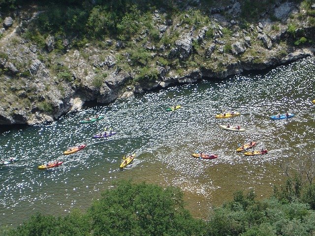
Aerial view of the harbour of Lorient
| ||
| ||
| البلد | فرنسا | |
| المنطقة | بريتاني | |
| الإقليم | Morbihan | |
| Arrondissement | Lorient | |
| Intercommunality | Pays de Lorient | |
| الحكم | ||
| • Mayor (2008–2014) | Norbert Métairie | |
| المساحة1 | 17٫48 كم² (6٫75 ميل²) | |
| التعداد(2007)2 | 58٬135 | |
| • الكثافة | 3٬300/km2 (8٬600/sq mi) | |
| منطقة التوقيت | CET (التوقيت العالمي المنسق+01:00) | |
| • الصيفي | CEST (UTC+02:00) | |
| INSEE/Postal code | 56121 /56100 | |
| Elevation | 0–46 م (0–151 قدم) | |
| 1 French Land Register data, which excludes lakes, ponds, glaciers > 1 km2 (0.386 sq mi or 247 acres) and river estuaries. 2Population without double counting: residents of multiple communes (e.g., students and military personnel) only counted once. | ||
لوريان (Lorient ؛ النطق الفرنسي: [lɔ.ʁjɑ̃]؛ بريتانية: An Oriant) هي commune وميناء بحري في Morbihan department في بريتاني في شمال غرب فرنسا.
التاريخ
قبل التاريخ والقدم الكلاسيكي
Beginning around 3000 BC, settlements in area of Lorient are attested by the presence of megalithic architecture. Ruins of Roman roads (linking Vannes to Quimper and Port-Louis to Carhaix) confirm Gallo-Roman presence.
Founding
In 1664, Jean-Baptiste Colbert founded the French East Indies Company. In June 1666, an ordinance of Louis XIV granted lands of Port-Louis to the company, along with Faouédic on the other side of the roadstead. One of its directors, Denis Langlois, bought lands at the confluence of the Scorff and the Blavet rivers, and built slipways. At first, it only served as a subsidiary of Port-Louis, where offices and warehouses were located. The following years, the operation was almost abandoned, but in 1675, during the Franco-Dutch War, the French East Indies Company scrapped its base in Le Havre since it was too exposed during wartime, and transferred its infrastructures to l'Enclot, out of which Lorient grew. The company then erected a chapel, workshops, forges, and offices, leaving Port-Louis permanently.
The French Royal Navy opened a base there in 1690, under the command of Colbert de Seignelay, who inherited his father's position as Secretary of State of the Navy. At the same time, privateers from Saint-Malo took shelter there. In 1700, the town grew out of l'Enclot following a law forcing people to leave the domain to move to the Faouédic heath. In 1702, there were about 6,000 inhabitants in Lorient, though activities slowed, and the town began to decline
Growth under the Company of the Indies
The town experienced a period of growth when John Law formed the Perpetual Company of the Indies by absorbing other chartered companies (including the French East India Company), and chose Lorient as its operative base. Despite the economic bubble caused by the Company in 1720, the city was still growing as it took part in the Atlantic triangular slave trade. From 1720 to 1790, 156 ships deported an estimated 43,000 slaves. In 1732, the Company decided to transfer its sales headquarters from Nantes to Lorient, and asked architect Jacques Gabriel to raise new buildings out of dimension stones to host these new activities, and to embellish the L'Enclos domain. Sales began in 1734, peaking up to 25 million livres tournois. In 1769, the Company's monopoly ended with the scrapping of the company itself, under the influence of the physiocrats.
Up until Company's closure, the city took advantage of its prosperity. In 1738, there were 14,000 inhabitants, or 20,000 considering the outlying villages of Kerentrech, Merville, La Perrière, Calvin, and Keryado, which are now neighbourhoods comprised in the present-day city limits. In 1735, new streets were laid down and in 1738, it was granted city status. Further work was undertaken as the streets began to be paved, wharfs and slipways were built along the Faouédic river, and thatched houses were replaced with stone buildings following 18th-century classical architecture style as it was the case for l'Enclos. In 1744, the city walls were erected, and proved quickly useful as Lorient was raided in September 1746. Following the demise of the Company, the city lost one-seventh of its population.
In 1769, the city evolved into a full-scale naval base for the Royal Navy when the King bought out the Company's infrastructures for 17,500,000 livres tournois. From 1775 on, the American revolutionary war brought a surge in activity, as many privateers hailed from Lorient. When the war ended, transatlantic lines opened to the الولايات المتحدة, and in 1785, a new commercial company started under Calonne's tutelage (then Controller-General of Finances) with the same goal as the previous entities, i.e. conducting trade in India and China, with again Lorient standing as its operative base.
The French Revolution and the subsequent Napoleonic wars put an end to trade for nearly two decades.
19th century to the beginning of the 20th century
Reconstruction
الجغرافيا
المسقط
البلدات المجاورة:
المناخ
| الشهر | يناير | فبراير | مارس | أبريل | مايو | يونيو | يوليو | أغسطس | سبتمبر | اكتوبر | نوفمبر | ديسمبر | العام |
|---|---|---|---|---|---|---|---|---|---|---|---|---|---|
| العظمى القياسية °س (°ف) | 16.8 (62.2) |
17.6 (63.7) |
23.3 (73.9) |
27.1 (80.8) |
29.8 (85.6) |
35.9 (96.6) |
34.9 (94.8) |
37.5 (99.5) |
30.6 (87.1) |
27.2 (81) |
19.6 (67.3) |
16.4 (61.5) |
37٫5 (99٫5) |
| العظمى المتوسطة °س (°ف) | 9.5 (49.1) |
9.9 (49.8) |
12.3 (54.1) |
14.4 (57.9) |
17.7 (63.9) |
20.6 (69.1) |
22.5 (72.5) |
22.6 (72.7) |
20.5 (68.9) |
16.6 (61.9) |
12.6 (54.7) |
10.0 (50) |
15٫8 (60٫4) |
| الصغرى المتوسطة °س (°ف) | 3.8 (38.8) |
3.4 (38.1) |
4.9 (40.8) |
6.1 (43) |
9.4 (48.9) |
11.7 (53.1) |
13.6 (56.5) |
13.4 (56.1) |
11.6 (52.9) |
9.5 (49.1) |
6.2 (43.2) |
4.1 (39.4) |
8٫2 (46٫8) |
| الصغرى القياسية °س (°ف) | -13.1 (8.4) |
-11.0 (12.2) |
-7.4 (18.7) |
-4.1 (24.6) |
-1.1 (30) |
1.6 (34.9) |
3.4 (38.1) |
4.1 (39.4) |
1.0 (33.8) |
-1.8 (28.8) |
-5.0 (23) |
-8.7 (16.3) |
-13٫1 (8٫4) |
| هطول mm (inches) | 108.3 (4.264) |
82.6 (3.252) |
72.9 (2.87) |
67.2 (2.646) |
74.6 (2.937) |
50.4 (1.984) |
56.0 (2.205) |
49.3 (1.941) |
70.5 (2.776) |
104.4 (4.11) |
103.0 (4.055) |
111.7 (4.398) |
950٫9 (37٫437) |
| % Humidity | 88 | 85 | 82 | 79 | 81 | 80 | 80 | 81 | 84 | 87 | 87 | 88 | 83٫5 |
| Avg. precipitation days | 14.5 | 11.0 | 11.9 | 11.1 | 10.9 | 7.4 | 8.3 | 7.5 | 8.8 | 13.5 | 13.5 | 14.0 | 132٫4 |
| Sunshine hours | 70.1 | 95.1 | 137.6 | 182.5 | 204.9 | 230.1 | 223.0 | 215.9 | 192.6 | 115.8 | 84.9 | 74.8 | 1٬827٫2 |
| Source #1: Météo France | |||||||||||||
| Source #2: Infoclimat.fr (humidity, 1961–1990) | |||||||||||||
السكان
In 2009, Lorient had a population of 57,812. In 2008, its intercommunality had 191,716 inhabitants. Lorient is the most populous commune in Morbihan département, although the préfecture is the slightly smaller commune of Vannes.
Inhabitants of Lorient are called Lorientais.
| التعداد التاريخي | ||
|---|---|---|
| السنة | تعداد | ±% |
| 1793 | 22٬318 | — |
| 1800 | 17٬837 | −20.1% |
| 1806 | 20٬553 | +15.2% |
| 1821 | 17٬115 | −16.7% |
| 1831 | 18٬322 | +7.1% |
| 1841 | 23٬621 | +28.9% |
| 1851 | 25٬694 | +8.8% |
| 1861 | 35٬462 | +38.0% |
| 1872 | 34٬660 | −2.3% |
| 1881 | 37٬812 | +9.1% |
| 1891 | 42٬116 | +11.4% |
| 1901 | 44٬640 | +6.0% |
| 1911 | 49٬039 | +9.9% |
| 1921 | 46٬314 | −5.6% |
| 1931 | 42٬853 | −7.5% |
| 1946 | 11٬838 | −72.4% |
| 1954 | 47٬095 | +297.8% |
| 1968 | 66٬444 | +41.1% |
| 1975 | 69٬769 | +5.0% |
| 1982 | 62٬554 | −10.3% |
| 1990 | 59٬271 | −5.2% |
| 1999 | 59٬189 | −0.1% |
| 2009 | 57٬812 | −2.3% |
| Sources: until 1962, from 1968 | ||
لغة البريتون
The municipality launched a linguistic plan through Ya d'ar brezhoneg on 25 January 2007.
In 2008, 2.71% of the children attended the bilingual schools in primary education.
الاقتصاد
الموانئ
Lorient is commonly referred to as "the five port city" (military, fishing, commercial, passengers and yachting). In 2010, the sector represented 9,600 direct jobs for a total 12,000 jobs (with indirect jobs accounted for), or 12% of local employment.
- Keroman fishing port : In 2010, with a catch of 27,000 tons, it was second only to Boulogne-sur-Mer regarding catch tonnage among French fishing ports, but first considering the cash value. It accounts for 3,000 jobs (including 700 fishermen) and 130 fishing vessels.
- Kergroise cargo port : With 2.6 million tons of cargo per year (including oil, cattle fodder, sand, containers), it ranks first in Brittany
- Marinas : mooring berths are dispatched on Lorient (370), Kernevel (1,000), Port-Louis (450), Gâvres (57) and Guidel (102). Additionally, there is a 800 مترs (2,600 قدم) long dock dedicated to offshore competitive sailing (Pôle course au large), recently built within the former Keroman submarine base.
- سفن الركاب : each year, more 457,500 passengers set sail to the nearby islands of Groix and Belle-Île-en-Mer.
- العسكرية: though no longer a French Navy base, new warships being built at DCNS temporarily dock on wharfs along the Scorff river.
العسكرية
Active units based near Lorient:
- Naval Commandos (Commando Marine): the special forces of the French Navy. Accordingly, it is one of the most selective units among the French armed forces, equivalent in their mission and affiliation to Navy SEALs or British Special Boat Service. Five out of the six existing naval commandos are based in Lanester, just across the Scorff river from Lorient. The Naval Fusilier & Commando Training School is also based here.
- Lann-Bihoué Naval Aviation Base: Five flottilles are based in Ploemeur. Their tasks include airborne early warning, maritime patrol and air-sea rescue.
قاعدة كرومان للغواصات
Lorient was the location of the Keroman Submarine Base. Grand Admiral Karl Dönitz decided to construct the base on 28 June 1940. Between February 1941 and January 1942 three gigantic reinforced concrete structures were built on the Keroman peninsula. They are called K1, K2 and K3. In 1944 work began on a fourth structure. The base was capable of sheltering thirty submarines. Lorient was damaged by Allied bombing raids but the naval base survived the war. Despite being surrounded by the U.S.Army, Lorient was held until May 1945 by the German army. The Germans refused to surrender because they could not destroy the base and its submarine pens, the Allies had decided to flatten the city and port of Lorient, to cut the supply lines to the U-boat bases. Between 14 January 1943 and 17 February 1943, as many as 500 high-explosive aerial bombs and more than 60,000 incendiary bombs were dropped on Lorient and the city was almost destroyed.
الثقافة
العلاقات الدولية
Twin towns — Sister cities
L'Orient is twinned with:
- Galway, Ireland, since 1978
- Vigo, Spain
- Wirral, United Kingdom
- Ventspils, Latvia
- Toluca, Mexico
- Ludwigshafen, Germany
- České Budějovice, Czech Republic
- Denizli, Turkey
See also
- Mississippi Company
- FC Lorient
- Festival Interceltique de Lorient
- Arrondissement of Lorient
- Communes of the Morbihan department
- Raid on Lorient (1746)
الهامش
- INSEE
- Notes
- ^ Chaumeil, Louis (1939). (in French). p. 66.CS1 maint: unrecognized language (link)
- ^ Chaumeil, Louis (1939). (in French). p. 67.CS1 maint: unrecognized language (link)
- ^ Chaumeil, Louis (1939). (in French). p. 68.CS1 maint: unrecognized language (link)
- ^ Chaumeil, Louis (1939). (in French). p. 69.CS1 maint: unrecognized language (link)
- ^ Chaumeil, Louis (1939). (in French). p. 70.CS1 maint: unrecognized language (link)
- ^ René Estienne, « Les archives des compagnies commerciales et la traite : l’exemple de la Compagnie des Indes », Service historique de la Défense, Lorient, janvier 2009
- ^ Chaumeil, Louis (1939). (in French). p. 71.CS1 maint: unrecognized language (link)
- ^ Chaumeil, Louis (1939). (in French). p. 73.CS1 maint: unrecognized language (link)
- ^ Chaumeil, Louis (1939). (in French). p. 72.CS1 maint: unrecognized language (link)
- ^ Chaumeil, Louis (1939). (in French). p. 74.CS1 maint: unrecognized language (link)
- ^ Chaumeil, Louis (1939). (in French). p. 75.CS1 maint: unrecognized language (link)
- ^ "Données climatiques de la station de Lorient" (in French). Meteo France. Retrieved 30 December 2015.CS1 maint: unrecognized language (link)
- ^ "Climat Bretagne" (in French). Meteo France. Retrieved 30 December 2015.CS1 maint: unrecognized language (link)
- ^ "Normes et records 1961-1990: Lorient-Lann Bihoué (56) - altitude 42m" (in French). Infoclimat. Retrieved 30 December 2015.CS1 maint: unrecognized language (link)
- ^ "INSEE". Retrieved 10 March 2013.
- ^ "Lorient Agglo". Retrieved 10 March 2013.
- ^ "EHESS". Retrieved 10 March 2013.
- ^ "INSEE - Statistiques locales" (PDF). Retrieved 10 March 2013.
- ^ (بالفرنسية) Ofis ar Brezhoneg:
- ^ "Lorient-ports". Retrieved 11 March 2013.
-
^ Josse, Charles (25 March 2011). Ouest-France http://www.ouest-france.fr/actu/actuLocale_-a-Lorient-le-maritime-pese-12-000-emplois-_40875-1739514------56121-aud_actu.Htm. Retrieved 11 March 2013. Missing or empty
|title=(help) -
^ Ouest-France.سبعة January 2011 http://www.ouest-france.fr/actu/actuLocale_-26-000-tonnes-de-poisson-au-port-de-peche-de-Lorient_40811-1646705------56121-aud_actu.Htm. Retrieved 11 March 2013. Missing or empty
|title=(help) - ^ "Lorient - Ports". Retrieved 11 March 2013.
- ^ "Ports - Pays de Lorient". Retrieved 11 March 2013.
- ^ In the French Navy nomenclature, commandos are understood as units, not individuals
- ^ Galway City Council - Town Twinnings
- ^ "British towns twinned with French towns". Archant Community Media Ltd. Retrieved 11 July 2013.
وصلات خارجية
| مشاع الفهم فيه ميديا متعلقة بموضوع Lorient. |
| Wikivoyage has a travel guide for لوريان. |
- Official website (in French)
- Ville de Lorient et Festival Interceltique Images
- Keroman submarine base
- Festival Interceltique de Lorient
- French Ministry of Culture list for Lorient (بالفرنسية)
- See pictures on Antonio Mucherino's web site
- Tourism office (in French)
نطقب:Morbihan communes