جغرافيا جنوب أفريقيا

عودة للموسوعة

جغرافيا جنوب أفريقيا

جغرافيا South Africa


القارة Africa
المنطقة Southern Africa
الإحداثيات
المساحة Ranked 25th
 • الإجمالية 1,220,813 kم2 (471,359 ميل2)
الخط الساحلي 2,798 kم (1,739 ميل)
الحدود Total land borders:
4,862 km
Botswana 1,840 km,
Lesotho 909 km,
Mozambique 491 km,
Namibia 967 km,
Swaziland 430 km,
Zimbabwe 225 km
أعلى نقطة Mafadi
3,450 m
أوطى نقطة Sea level
0 m
أطول نهر Orange River
2,200 km
أكبر بحيرة Lake Chrissie

جغرافيا جنوب أفريقيا

تقع جمهورية اتحاد أقريقيا في أقصي الطرف الجنوبي من القارة الأفريقية، وتحدها نامبيا من الشمال الغربي، وبتسوانا وزمبابوي من الشمال، وموزمبيق من الشمال الشرقي، وباقي حدودها على المحيط الهندي والأطلسي. وتبلغ مساحة جنوب أفريقيا 1,331,000 كم، وسكان الاتحاد في سنة 1988 م 33,763,000 نسمة.

صورة ساتلية لجنوب أفريقيا

ولاتحاد جنوب أفريقيا عاصمتان، تشريعية وهي مدينة الكيب وإدارية وهي پريتوريا وسكان العاصمة حوالي 750,000 نسمة، ومدينة الكيب أكثر من مليون نسمة وتنقسم الجمهورية إلى أربع ولايات هي: الكاب واورانج وناتال وترنسفال، ومن أبرز المدن ديربان (843 ألفاً) وجوهانسبرگ وسكانها 1,700,000 نسمة، ومن المدن الهامة پورت اليزابيث.

أهم انهارها أورانج Orange وڤال Vaal وليمپوپوLimpopo. وأطولها نهر أورانج طوله 2100 كم ويصب بالأطلسي.

الأرض

The Southern African Central Plateau edged by the Great Escarpment.

معظم أرض جمهورية اتحاد جنوب أفريقيا هضبة مرتفعة يزيد أرتفاعها على ألف متر ، ويحيط بهذه الهضبة من الجنوب، والشرق نطاق جبلي يثمتل في جبال دراكثريرج، والكاب، وتفصل هذه الجبال بين الهضبة في الداخل، والسهول الساحلية ، وتشغل الهضبة وسط جنوب أفريقيا، وفي شمالها منطقة ترنسفال، وفي الشمال الغربي صحراء نامبيا، وفي القسم الشرقي من الهضبة يوجد أقليم الفلد الأعلي ثم الفلد النخفض، وفي الشمال الشرقي يوجد إقليم البوشلد، وفي شرقي جبال دراكنزبرج، ويوجد أقليما الكروالأكبر والكروالأصغر. وأهم أنهارها نهر أورنج ونهر الڤال، وينبعان من الشرق ويصبان في الغرب في المحيط الأطلنطي، ويشكل القسم الأدنى من نهر أورنج الحدود السياسية بين انحاد جنوب أفريقيا، ونامبيا، ثم نهر لمبوبوويتجه إلى الشمال ثم إلى الشرق فيصب في المحيط الهندي.


الهضبة الوسطى

An approximate SW-NE cross section through South Africa with the Cape Peninsula (with Table Mountain) on left, and north-eastern KwaZulu-Natal on the right. Diagrammatic and only roughly to scale. It shows the major geological structures (coloured layers) that dominate the southern and eastern parts of the country, as well as the relationship between the Central Plateau, the Cape Fold Mountains, and the Drakensberg escarpment. The significance and origin of the geological layers can be found under the headings "Karoo Supergroup" and "Cape Supergroup".
A diagrammatic 400 km north-south cross-section through the southern portion of the country near Calitzdorp in the Little Karoo (approximately 21° 30’ E), showing the relationship between the Cape Fold Mountains (and their geological structure) and the geology of the Little and Great Karoo, as well as the position of the Great Escarpment. The colour code for the geological layers is the same as those used in the diagram on the left. The heavy black line flanked by opposing arrows is the fault that runs for nearly 300 km along the southern edge of the Swartberg Mountains. The Swartberg Mountain range owes some of its great height to upliftment along this fault line. The subsurface structures are not to scale.


السهل الساحلي

The coastal plain, which varies in width from about 60 km in the north-west to over 250 km in the north-east, generally slopes gently downwards from the foot of the escarpment to the coast. Numerous relatively small rivers drain the area, being more numerous in the KwaZulu-Natal and Eastern Midlands regions, where they arise on the well watered slopes of the high escarpment, than elsewhere. In the west there are very few such rivers because of the aridity of the region.

Cape Fold Mountains

Folded rock formations of the Swartberg. This extreme folding is characteristic of all the Cape Fold Mountain ranges


الحياة النباتية والحيوانية

Fynbos, a floral kingdom unique to South Africa, is found near Cape Town
Swartberg mountains near the town of Oudtshoorn
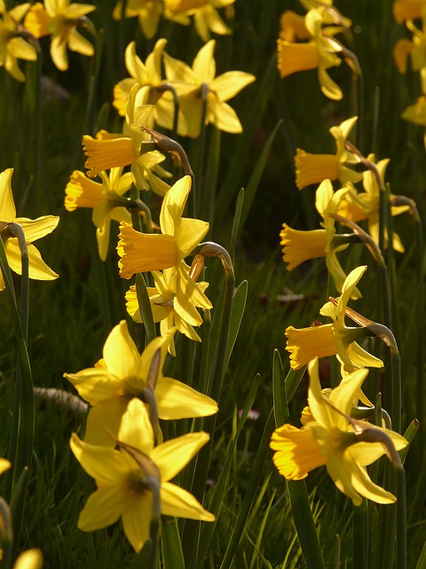
A field of flowers in Weskus National Park.


المناخ

مناخ جنوب أفريقيا متعدد السمات بسبب مسقطها، وأرتفاع أرضها غير أنة يتفاوت من منطقة لأخرى بسبب اتساع رقعتها ، ويتساقط المطر في بعض أجزائها صيفاً، غير حتى القسم الجنوبي من البلاد يتسم بمناخ شبيه بمناخ البحر المتوسط ، وتتساقط أمطاره في الشتاء ، وتسود المناطق الشمالية الغربية مظاهر المناخ الصحراوي ، بينما يسود الساحل الشرقي طراز مداري رطب في أقليم ناتال ، وعلى الهضبة مناخ مداري شبه جاف .


متوسطات الطقس لكيپ تاون، جنوب أفريقيا
شهر يناير فبراير مارس أبريل مايو يونيو يوليو أغسطس سبتمبر اكتوبر نوفمبر ديسمبر السنة
متوسط العظمى °م (°ف) 27 (81) 28 (82) 26 (79) 24 (75) 20 (68) 18 (64) 17 (63) 18 (64) 19 (66) 22 (72) 24 (75) 26 (79) 28 (82)
متوسط الصغرى °م (°ف) 16 (61) 16 (61) 15 (59) 13 (55) 10 (50) 8 (46) 8 (46) 8 (46) 9 (48) 11 (52) 14 (57) 15 (59) 8 (46)
هطول الأمطار mm (بوصة) 16.5 (0.6) 13 (0.5) 20 (0.8) 54 (2.1) 92 (3.6) 111 (4.4) 96 (3.8) 87 (3.4) 56 (2.2) 40 (1.6) 24 (0.9) 18 (0.7) 627 (24٫7)
المصدر: EuroWEATHER 2008-02-22


التقسيمات الإقليمية

هاي‌ڤلد

هاي‌ڤلد in winter in Gauteng Province north of Johannesburg. The hills in the background are the Magaliesberg, which are generally regarded as the local northern boundary of the Highveld, with the Bushveld beyond.


Lowveld

An elephant in the Kruger National Park in the Lowveld


بوش‌ڤلد

خريطة حيوم بوش‌ڤلد في شمال شرق جنوب أفريقيا. Being defined botanically, it includes much of the Lowveld, and is therefore more extensive than the geographical region generally termed البوش‌ڤلد. Compare this map with the one on the right above.


كارو


Flat topped hills (called Karoo Koppies) are highly characteristic of the southern and southwestern Great Karoo landscape (especially on the Central Plateau). These hills are capped by hard, erosion resistant dolerite sills. This is solidified lava that was forced under high pressure between the horizontal strata of the sedimentary rocks that make up most of the Karoo’s geology. This occurred about 182 million years ago, when huge volumes of lava were extruded over most of Southern Africa and adjoining regions of Gondwana, both on the surface and deep below the surface between the sedimentary strata. The resultant bulging of what later became Southern Africa heralded the break-up of Gondwana. Since this massive extrusion of lava, Southern Africa has undergone a prolonged period of erosion exposing the older softer rocks, except where they were protected by a cap of dolerite. This photograph was taken in the western region of the Upper Karoo near Calvinia. Note the general flatness of the arid plains between the koppies.
Karoo landscape, showing the shrubland that characterizes most of the Karoo. The mountain range in the far distance is the Nuweberg section of the Great Escarpment. The view is from the Lower Karoo looking northwards.


KwaZulu-Natal

A view of the Mngeni River valley near Howick Falls.


Upland savannah near Pietermaritzburg.


بوشمانلاند

Typical Bushmanland landscape, emphasising its aridity and overall peneplain flatness. The hills in the background are formed by dolerite-like, erosion-resistant intrusions or dykes of unknown, but probably very ancient, age which have partially withstood the erosion of the rest of Bushmanland over the past 150 million ago.
A Sociable weavers' (Philetairus socius) nest in a Quiver tree (or Kokerboom) (Aloe dichotoma). Quiver trees only occur in Bushmanland, and neighbouring Namaqualand, and Southern Namibia, usually widely scattered across the arid landscape, but occasionally in dense enough stands to qualify as Quiver tree "forests", for instance on the outskirts of Kenhardt. Sociable weaver nests are highly characteristic of Bushmanland, but usually on the telephone poles along the roads. In the absence of telephone poles in the treeless plains of Bushmanland Quiver trees are favourite nesting sites for Sociable weavers.


ناماكوالاند

Ventilation shaft erected by the Cape Copper Mining Company in 1880 in Okiep
Spring flowers in Namaqualand.


المحيطات المحيطة

The courses of the warm Agulhas current (red) along the east coast of South Africa, and the cold Benguela current (blue) along the west coast. Note that the Benguela current does not originate from Antarctic waters in the South Atlantic Ocean, but from upwelling of water from the cold depths of the Atlantic Ocean against the west coast of the continent. The two currents do not "meet" anywhere along the south coast of Africa.
The chlorophyll concentration (or plankton density) in the oceans surrounding Southern Africa. Note the very high plankton density (the red colour) in the cold waters off the western coast. The temperature of the water and its fertility is due to its upwelling, along the coast, from the depths of the Atlantic Ocean.


النقاط القصوى

المدن والبلدات الرئيسية في جنوب أفريقيا

This is a list of the extreme points of South Africa, the points that are farther north, south, east or west than any other location in the country.

Including the Prince Edward Islands
  • Northernmost Point: Over Vlakte farm, Limpopo Province ()
  • Southernmost Point: Marion Island, Prince Edward Islands ()
  • Westernmost Point: Orange River Mouth (near Alexander Bay), Northern Cape ()
  • Easternmost Point: Prince Edward Island, Prince Edward Islands ()
South African mainland
  • Northernmost Point: Over Vlakte farm, Limpopo Province
  • Southernmost Point: Cape Agulhas, Western Cape ()
  • Westernmost Point: Orange River Mouth, Northern Cape
  • Easternmost Point: beach below Monte Ouro (near Kosi Bay), KwaZulu-Natal ()
  • South-Westernmost Point: Cape of Good Hope, Western Cape ()
  • South Easternmost Point: Shebeen Point, Eastern Cape ()

See also

  • Provinces of South Africa
  • Districts of South Africa
  • Municipalities of South Africa
  • List of mountains in South Africa
  • List of rivers of South Africa
  • Summary of South Africa's Geography

== المراجع ==

  1. ^ "Euroweather - Climate averages: Cape Town, South Africa" (in English). Retrieved 2008-02-22.CS1 maint: unrecognized language (link)
  2. ^ Palgrave, Keith Coates; Drummond, R.B. (1977). Moll, E.J. (ed.). Trees of Southern Africa. Cape Town: C. Struik Publishers. pp. 78–79. ISBN .
  3. ^ Van Wyk, Braam; Van Wyk, Piet (1997). Field Guide to Trees of Southern Africa. Cape Town: C. Struik Publishers. pp. 44–45. ISBN .
  4. ^ Team, AirPano. "Cape of Good Hope, South Africa. The Most South-Western Point of The African Continent". AirPano.
  • Some material in this article is adapted from the World Factbook 2006.

وصلات خارجية

  • Kleynhans, CJ, Thirion, C and Moolman, J (2005). "A Level I River Ecoregion classification System for South Africa, Lesotho and Swaziland. Report No. N/0000/00/REQ0104" (PDF). Resource Quality Services, Department of Water Affairs and Forestry, Pretoria, South Africa.CS1 maint: multiple names: authors list (link)
  • "Wayback Machine" (PDF). 29 November 2007. Archived from the original (PDF) on 29 November 2007. Retrieved 10 August 2018.
  • Wolfgang E. ELSTON. "THE PROTEROZOIC BUSHVELD COMPLEX, SOUTH AFRICA: PLUME, ASTROBLEME OR BOTH?" (PDF). Mantleplumes.org. Retrieved 10 August 2018.
  • "Wayback Machine".ستة February 2007. Archived from the original onستة February 2007. Retrieved 10 August 2018.
  • "South Africa - UNESCO World Heritage Centre". Whc.unesco.org. Retrieved 10 August 2018.
تاريخ النشر: 2020-06-06 11:16:06
التصنيفات: CS1 maint: unrecognized language, Pages using deprecated image syntax, CS1 maint: multiple names: authors list, CS1 errors: deprecated parameters, جغرافيا جنوب أفريقيا, صفحات تستعمل قالبا ببيانات مكررة

مقالات أخرى من الموسوعة

سحابة الكلمات المفتاحية، مما يبحث عنه الزوار في كشاف:

آخر الأخبار حول العالم

بعد فسخ عقد أنور الغازي بسبب فلسطين.. عروض أروبية تنهال على اللاعب

المصدر: الأيام 24 - المغرب التصنيف: سياسة
تاريخ الخبر: 2024-02-21 15:12:21
مستوى الصحة: 69% الأهمية: 83%

"الأونروا": أكثر من 300 ألف طفل في غزة محرومون من التعليم

المصدر: RT Arabic - روسيا التصنيف: سياسة
تاريخ الخبر: 2024-02-21 15:09:23
مستوى الصحة: 77% الأهمية: 90%

وكيل كلوب يكشف موقف موكله النهائي من تدريب بايرن ميونخ وبرشلونة

المصدر: RT Arabic - روسيا التصنيف: سياسة
تاريخ الخبر: 2024-02-21 15:09:34
مستوى الصحة: 77% الأهمية: 88%

متى يعرض أخنوش حصيلة حكومته المرحلية أمام البرلمان؟

المصدر: الأيام 24 - المغرب التصنيف: سياسة
تاريخ الخبر: 2024-02-21 15:12:30
مستوى الصحة: 74% الأهمية: 76%

الرئاسيات الروسية.. ثلاثة مرشحين "يتنافسون" على الرتبة الثانية

المصدر: تيل كيل عربي - المغرب التصنيف: سياسة
تاريخ الخبر: 2024-02-21 15:13:49
مستوى الصحة: 58% الأهمية: 63%

وجد أخنوش في استقباله.. سانشيز يحل بالمغرب

المصدر: تيل كيل عربي - المغرب التصنيف: سياسة
تاريخ الخبر: 2024-02-21 15:13:50
مستوى الصحة: 60% الأهمية: 54%

مكافآت كبيرة للاعبي ميدياما حال الفوز على الأهلي

المصدر: الأهلى . كوم - مصر التصنيف: رياضة
تاريخ الخبر: 2024-02-21 15:11:44
مستوى الصحة: 36% الأهمية: 48%

رئيس جماعة حجر النحل وسط زوبعة جديدة

المصدر: تيل كيل عربي - المغرب التصنيف: سياسة
تاريخ الخبر: 2024-02-21 15:13:52
مستوى الصحة: 52% الأهمية: 54%

تفتيش شخصين بمحطة قطار طنجة يسفر عن مفاجأة

المصدر: الأيام 24 - المغرب التصنيف: سياسة
تاريخ الخبر: 2024-02-21 15:12:42
مستوى الصحة: 65% الأهمية: 73%

سجن عكاشة يخرج عن صمته بشأن “تدهور الوضع الصحي” لسعيد الناصري

المصدر: الأيام 24 - المغرب التصنيف: سياسة
تاريخ الخبر: 2024-02-21 15:12:47
مستوى الصحة: 60% الأهمية: 80%

بوتين يتفقد "البجعات البيضاء" حاملات القنابل النووية (فيديو)

المصدر: RT Arabic - روسيا التصنيف: سياسة
تاريخ الخبر: 2024-02-21 15:09:32
مستوى الصحة: 85% الأهمية: 90%

كلوب يكشف طبيعة إصابة صلاح قبيل مواجهة ليفربول ولوتون تاون

المصدر: RT Arabic - روسيا التصنيف: سياسة
تاريخ الخبر: 2024-02-21 15:09:35
مستوى الصحة: 89% الأهمية: 96%

رئيس حكومة إسبانيا يحل بالرباط وسط ترقب لاستقباله من طرف الملك

المصدر: الأيام 24 - المغرب التصنيف: سياسة
تاريخ الخبر: 2024-02-21 15:12:38
مستوى الصحة: 67% الأهمية: 84%

تحميل تطبيق المنصة العربية