إيست رايدينگ اوف يوركشاير
| مقاطعة | |
|
الشعار: العراقة والتقدم | |
| الدولة | المملكة المتحدة |
|---|---|
| البلد | إنگلترة |
| المنطقة | يوركشاير وهمبر |
| الأصل | تاريخية |
| مقاطعة احتفالية | |
| المساحة | [] |
| – الترتيب | of 48 |
| – الترتيب | of 48 |
| الكثافة | [] |
| الأعراق |
Figures for East Riding of Yorkshire UA: 93.0% White, British 2.0% White, other 1.9% S. Asian 0.9% Mixed 0.9% White, Irish 0.6% Black |
| منطقة التوقيت | GMT (UTC) |
| – الصيفي (DST) | BST (UTC+1) |
إيست رايدينگ اوف يوركشاير East Riding of Yorkshire، أوشرق يوركشاير East Yorkshire، هي منطقة حكومة محلية بحالة سلطة موحدة، ومقاطعة احتفالية في إنگلترة. لأغراض احتفالية، تضم المقاطعة أيضاً مدينة كينگستون اپون هول، وهي سلطة متوحدة منفصلة. سميت المدينة على اسم مقاطعة إيست رايدنگ يوركشاير التاريخية.
التاريخ
الجغرافيا
المسقط
الجيولوجيا
Solid geology of the East Riding
الأفق
The chalk cliffs at Flamborough Head
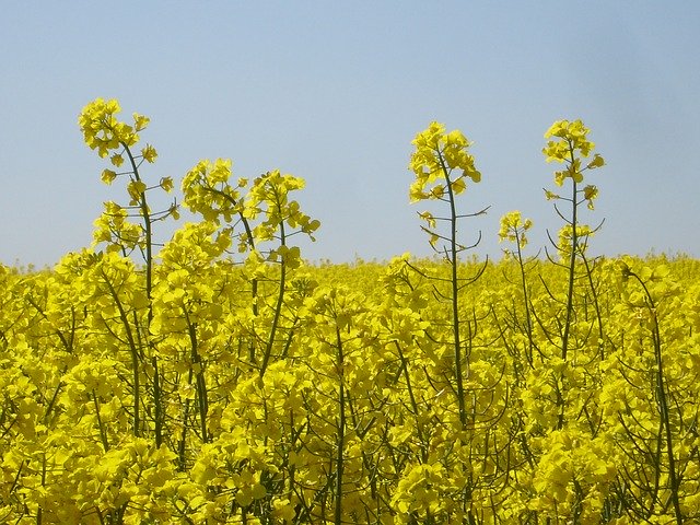
Skidby Windmill is surrounded by fertile agricultural land typical of the East Riding.
المناخ
الحكومة
التاريخ الاداري
East Riding of Yorkshire boundaries – historic county (light pink and blue), ceremonial county (light pink & darker pink)
الادارة الحالية
County Hall, Beverley, the headquarters of the council
نتائج الانتخابات المحلية 2007
| نتائج انتخابات مجلس إيست رايدينگ اوف يوركشاير 2007 | |||||||||||
|---|---|---|---|---|---|---|---|---|---|---|---|
| الحزب | المقاعد | فاز | خسر | الفوز/المكسب الصافي | المقاعد% | الأصوات% | الأصوات | +/− | |||
| حزب المحافظين | 47 | +18 | 69.1 | {{{net seats % | {{{votes R1 | {{{votes % R1 | {{{net % R1 | {{{votes R2 | {{{votes % R2 | {{{net % R2 | |
| حزب الديمقراطيين الليبراليين | 12 | -10 | 17.6 | {{{net seats % | {{{votes R1 | {{{votes % R1 | {{{net % R1 | {{{votes R2 | {{{votes % R2 | {{{net % R2 | |
| حزب العمال | 3 | -5 | 4.4 | {{{net seats % | {{{votes R1 | {{{votes % R1 | {{{net % R1 | {{{votes R2 | {{{votes % R2 | {{{net % R2 | |
| مستقل | 5 | -3 | 7.4 | {{{net seats % | {{{votes R1 | {{{votes % R1 | {{{net % R1 | {{{votes R2 | {{{votes % R2 | {{{net % R2 | |
| الديمقراطي الاشتراكي | 1 | -1 | 1.5 | {{{net seats % | {{{votes R1 | {{{votes % R1 | {{{net % R1 | {{{votes R2 | {{{votes % R2 | {{{net % R2 | |
| BNP | 0 | 0 | 0 | {{{net seats % | {{{votes R1 | {{{votes % R1 | {{{net % R1 | {{{votes R2 | {{{votes % R2 | {{{net % R2 | |
| الخضر | 0 | 0 | 0 | {{{net seats % | {{{votes R1 | {{{votes % R1 | {{{net % R1 | {{{votes R2 | {{{votes % R2 | {{{net % R2 | |
| الديمقراطيون الإنگليز | 0 | 0 | 0 | {{{net seats % | {{{votes R1 | {{{votes % R1 | {{{net % R1 | {{{votes R2 | {{{votes % R2 | {{{net % R2 | |
برلمان وستمنستر
| General Election 2010 : East Riding of Yorkshire (including Kingston upon Hull) | ||||||||||||
|---|---|---|---|---|---|---|---|---|---|---|---|---|
| Conservative | Labour | Liberal Democrats | UKIP | BNP | English Democrats | Green | Social Democrat | National Front | Others | Trade Union & Socialist | Turnout | |
|
109,950 +12,622 |
86,597 −19,328 |
70,047 +8,298 |
11,527 +6,220 |
9,885 +8,321 |
3,276 N/A |
2,595 +1,737 |
914 N/A |
880 N/A |
225 −302 |
150 N/A |
296,046 +22,288 |
|
| عدد جميع المقاعد في 2010 | |||||||||||
|---|---|---|---|---|---|---|---|---|---|---|---|
| المحافظون | العمل | Liberal Democrats | UKIP | BNP | الديمقراطيون الإنگليز | الخضر | الديمقراطيون الاشتراكيون | الجبهة الوطنية | آخرون | الاتحاد التجاري والاشتراكي | |
| 4 | 3 | 0 | 0 | 0 | 0 | 0 | 0 | 0 | 0 | 0 | |
البرلمان الاوروپي
الديموغرافيا
| الدين في شرق يوركشاير 2001 | |||
|---|---|---|---|
| تعدد المملكة المتحدة 2001 | إ رايدينگ | وهمبر | إنگلترة |
| مسيحيون | 79.67% | 73.07% | 71.74% |
| بلا ديانة | 11.90% | 14.09% | 14.59% |
| مسلمون | 0.27% | 3.81% | 3.1% |
| بوذيون | 0.13% | 0.14% | 0.28% |
| هندوس | 0.18% | 0.32% | 1.11% |
| يهود | 0.13% | 0.23% | 0.52% |
| السيخ | 0.06% | 0.38% | 0.67% |
| ديانات أخرى | 0.16% | 0.19% | 0.29% |
| لم يصرح بدينه | 7.50% | 7.77% | 7.69% |
البلدات والقرى
|
|
with Kingston upon Hull shown within Beverley Bridlington Cottingham Driffield Goole Hedon Hessle Hornsea Howden Hull Market Weighton Pocklington Snaith and Cowick Withernsea Rivers, Motorways, 'A' Roads, المستوطنات |
أكبر المستوطنات (حسب السكان): Kingston upon Hull (257,100) |
|
أهم الأماكن
Beverley's 11th century minster is one of the county's most visited sites.
أماكن دينية
النقل
The Humber Bridge connects the East Riding with North Lincolnshire.
الاقتصاد
Easington gas terminal
Beverley on market day
| Year | القيمة المحلية الصافية المضافة | الزرراعة | الصناعة | Services |
|---|---|---|---|---|
| 1995 | 2,708 | 299 | 896 | 1,513 |
| 2000 | 3,006 | 209 | 1,090 | 1,707 |
| 2003 | 3,783 | 233 | 1,106 | 2,444 |
- المكونات قد تكون غير مضافة للإجمالي لأنها مقربة
- تضم الصيد والغابات
- تضم الطاقة والإنشاءات
- ضم خدمات الوساطة المالية المقاسة بطريقة غير مباشرة
الطاقة المتجددة
Wind farm at Out Newton
التعليم
The Derwent Building at the University of Hull.
الخدمات العامة
Hornsea fire station
الرياضة
KC Stadium, Hull
الإعلام
انظر أيضاً
- Custos Rotulorum of the East Riding of Yorkshire – Keepers of the Rolls
- East Riding of Yorkshire local elections
- Grade I listed buildings in the East Riding of Yorkshire
- Grade I listed churches in the East Riding of Yorkshire
- Grade II* listed buildings in the East Riding of Yorkshire
- List of High Sheriffs of the East Riding of Yorkshire
- List of Lord Lieutenants of the East Riding of Yorkshire
المصادر
- ^ Guardian (Office for National Statistics) 2011
- ^ "East Riding of Yorkshire Council District Council Election" (PDF). East Riding of Yorkshire Council. ثلاثة May 2007. Archived from the original (PDF) on 20 February 2012. Retrieved 13 June 2013.
- ^ "English local elections 2007 – East Riding of Yorkshire". BBC News Online. أربعة May 2007. Retrieved 9 August 2009.
- ^ "2001 Census: Census Area Statistics: Key Figures: Area: East Riding of Yorkshire (Local Authority)". Neighbourhood Statistics. Office for National Statistics. Retrieved 3 October 2009.
المراجع
- Allison, K.J. (1976). The East Riding of Yorkshire Landscape. The Making of the English Landscape. London: Hodder and Stoughton Limited. ISBN .
- Van de Noort, Robert (2004). The Humber Wetlands. Landscapes of Britain. Macclesfield, Cheshire: Windgather Press. ISBN .
- Muir, Richard (1997). The Yorkshire Countryside. A Landscape History. Edinburgh: Keele University Press. ISBN .
- Wilson, Vernon (1948). East Yorkshire and Lincolnshire. British Regional Geology. London: HMSO. OCLC 2281266.
وصلات خارجية
| مشاع الفهم فيه ميديا متعلقة بموضوع East Riding of Yorkshire. |
- Data Observatory – East Riding of Yorkshire Council
- Official Tourism information for East Yorkshire
- Bridlington Information
- East Riding of Yorkshire Council
- Many photographs of the East Riding of Yorkshire
- East Riding online
- East Riding of Yorkshire: assessment of archaeological resource in aggregate areas
- إيست رايدينگ اوف يوركشاير at the Open Directory Project
Coordinates: