پيا
پيا | |
|---|---|
مدينة وبلدية
| |
|
بالألبانية: Peja or Pejë بالصربية: Пећ or Peć (بالهجرية: İpek) | |
|
From top (left to right):
Peć city center, Zenel Beg Tower (Kulla), Rugova Canyon, Ethnological Museum, Old Bazaar, Bistrica River, Patriarchal Monastery of Peć and the train station of Peć. | |
|
پيا | |
| الإحداثيات: | |
| البلد | كوسوڤو |
| مقاطعة | مقاطعة پيا |
| الحكم | |
| • العمدة | گازمند مهاجري |
| المساحة | |
| • مدينة وبلدية | 603 كم² (233 ميل²) |
| • الحضر | 14٬008 كم² (5٬409 ميل²) |
| • العمران | 21 كم² (8 ميل²) |
| الارتفاع | 550 m (1٬800 ft) |
| التعداد(2014) | |
| • مدينة وبلدية | 97٬776 |
| • الكثافة | 160/km2 (420/sq mi) |
| • العمرانية | 60٬000 |
| اعتبارا من 2009[تحديث] | |
| منطقة التوقيت | CET (التوقيت العالمي المنسق+1) |
| • الصيفي | CEST (UTC+2) |
| ZIP code | 30000 |
| مفتاح الهاتف | +383 39 |
| تسجيل السيارة | 03 |
| المسقط الإلكتروني | Municipality of Peć |
پيا (Peja؛ بالألبانية: Pejë) أوپچ (Peć؛ سيريلية صربية: Пећ) هي مدينة في غرب كوسوڤو، and the administrative centre of the homonymous district. The municipality covers an area of 602 kم2 (232 ميل2), including the city of Peć and 95 villages; it is divided into 28 territorial communities. اعتبارا من 2014[تحديث], the whole municipality has a population of approximately 97,776, of which ca. 60,000 live in the city of Peć.
Geographically, it is located in a important location on the Peć Bistrica, a tributary of the White Drin to the east of the Prokletije Mountains. The Rugova Canyon is one of Europe's longest and deepest canyons and is about three kilometres from the city of Peć. The city is located some 250 kilometres (155 miles) north of Tirana, Albania, 150 kilometres (93 miles) north-west of Skopje, جمهورية مقدونيا, 85 kilometres (52 miles) west of Pristina, Kosovo and some 280 kilometres (173 miles) east of Podgorica, الجبل الأسود.
In medieval times the city was the seat of the Serbian Orthodox Church in 1346. Later in 1899, the Albanian political organization, رابطة پيا، تأسست في المدينة.
الاسم
In Serbian, پيا peć means "furnace" or "cave", and its name is probably connected with nearby caves in the Rugova Canyon which served as hermit cells for Serbian Orthodox monks. In medieval Ragusan documents, the Serbian name of the city (Peć, lit. "furnace") is sometimes translated as Forno, meaning "furnace" in Italian. During Ottoman rule, it was known as Ottoman Turkish İpek (ايپك). The Albanian name's definite form is Peja and the indefinite Pejë. Other names of the city include Latin Pescium and Greek Episkion (Επισκιον).
التاريخ
التاريخ القديم والوسيط
The city is located in a strategic position on the Lumbardhi i Pejës، رافد درين الأبيض إلى الشرق من الألپ الألبانية. The medieval city was possibly built on the ruins of Siparant(um), a Roman municipium (town or city). The area has the most unearthed stelae in all of Kosovo.
العصر العثماني
الجغرافيا
المسقط
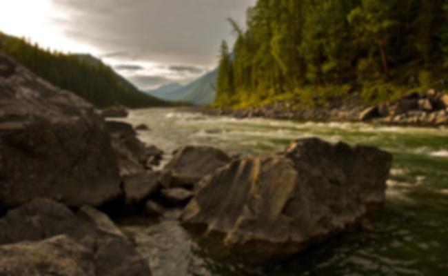
المدينة في غرب كوسوڤوتقع بالقرب من Rugova Canyon or Gorge. روگوڤا هي منطقة جبلية يمكن دخولها من الجزء الشمالي الغربي لمدينة پيا. وهي المنطقة الثالثة في پروكلتية. In 2013 it became a National Park of the جمهورية كوسوڤو. Rugova is known for its natural beauty and access to the mountains.
المناخ
| بيانات مناخ پيا (1961-1990) | |||||||||||||
|---|---|---|---|---|---|---|---|---|---|---|---|---|---|
| الشهر | يناير | فبراير | مارس | أبريل | مايو | يونيو | يوليو | أغسطس | سبتمبر | اكتوبر | نوفمبر | ديسمبر | العام |
| العظمى القياسية °س (°ف) | 15.4 (59.7) |
22.6 (72.7) |
25.0 (77) |
28.0 (82.4) |
31.5 (88.7) |
35.8 (96.4) |
38.2 (100.8) |
35.9 (96.6) |
34.1 (93.4) |
28.3 (82.9) |
22.9 (73.2) |
18.9 (66) |
38٫2 (100٫8) |
| العظمى المتوسطة °س (°ف) | 2.8 (37) |
6.0 (42.8) |
10.9 (51.6) |
16.1 (61) |
20.9 (69.6) |
24.1 (75.4) |
26.5 (79.7) |
26.4 (79.5) |
22.7 (72.9) |
16.9 (62.4) |
10.1 (50.2) |
4.5 (40.1) |
15٫7 (60٫3) |
| المتوسط اليومي °س (°ف) | -0.5 (31.1) |
2.1 (35.8) |
6.4 (43.5) |
11.2 (52.2) |
15.9 (60.6) |
19.0 (66.2) |
21.1 (70) |
20.8 (69.4) |
17.2 (63) |
11.8 (53.2) |
5.9 (42.6) |
1.2 (34.2) |
11٫1 (52) |
| الصغرى المتوسطة °س (°ف) | -3.6 (25.5) |
-1.5 (29.3) |
2.0 (35.6) |
6.1 (43) |
10.3 (50.5) |
13.3 (55.9) |
15.0 (59) |
14.8 (58.6) |
11.5 (52.7) |
6.8 (44.2) |
2.3 (36.1) |
-1.8 (28.8) |
6٫3 (43٫3) |
| الصغرى القياسية °س (°ف) | -24.8 (-12.6) |
-19.3 (-2.7) |
-13.6 (7.5) |
-3.8 (25.2) |
0.6 (33.1) |
3.5 (38.3) |
6.7 (44.1) |
5.2 (41.4) |
-1.2 (29.8) |
-4.8 (23.4) |
-15.3 (4.5) |
-15.2 (4.6) |
-24٫8 (-12٫6) |
| هطول mm (inches) | 85.9 (3.382) |
71.5 (2.815) |
65.2 (2.567) |
67.2 (2.646) |
68.2 (2.685) |
53.0 (2.087) |
54.7 (2.154) |
48.0 (1.89) |
52.1 (2.051) |
75.3 (2.965) |
118.2 (4.654) |
91.4 (3.598) |
850٫7 (33٫492) |
| % Humidity | 81 | 75 | 68 | 63 | 64 | 64 | 60 | 60 | 67 | 73 | 81 | 83 | 70 |
| Avg. precipitation days (≥ 0.1 mm) | 12.0 | 12.3 | 11.3 | 11.5 | 13.0 | 13.2 | 9.9 | 8.7 | 8.1 | 9.5 | 12.3 | 13.3 | 135٫1 |
| Sunshine hours | 69.5 | 93.3 | 143.0 | 172.0 | 207.8 | 257.7 | 274.3 | 264.9 | 206.3 | 152.6 | 86.8 | 55.3 | 1٬983٫5 |
| Source: Republic Hydrometeorological Service of Serbia | |||||||||||||
الديمغرافيا
| Year/Population | Albanians | % | Serbs | % | Montenegrins | % | Roma (Ashkali, Egyptians) | % | Bosniaks | % | Others | % | Total |
|---|---|---|---|---|---|---|---|---|---|---|---|---|---|
| 1961 Census | 41,532 | 62.35 | 8,852 | 13.28 | 12,701 | 19.05 | 728 | 1.09 | 1,397 | 2.1 | 66,656 | ||
| 1971 Census | 63,193 | 70.12 | 9,298 | 10.31 | 11,306 | 12.54 | 433 | 0.48 | 5,203 | 5.77 | 90,124 | ||
| 1981 Census | 79,965 | 71.99 | 7,995 | 7.2 | 9,796 | 8.82 | 3,844 | 3.46 | 8,739 | 7.86 | 111,071 | ||
| 1991 Census | 96,441 | 75.5 | 7,815 | 6.11 | 6,960 | 5.44 | 4,442 | 3.5 | 9,875 | 7.72 | 127,796 | ||
| January 1999 | ~104,600 | ~92 | n/a | n/a | n/a | n/a | ~3,500–4,000 | ~3.3 | n/a | n/a | ~4,000–4,200 | ~3.6 | ~113,000 |
| 2011 census | 87,975 | 91.2 | 332 | 0.4 | 3,836 | 3.9 | 3,786 | 3.9 | 521 | 0.5 | 96,450 | ||
| Source: Yugoslav Population Censuses for data through 1991, OSCE estimates for data from 1999, and 2011 census from Kosovo Republic. | |||||||||||||
الثقافة
International relations
Peć is twinned with Gjilan which is also in Kosovo; Tobolsk in Russia and Nilüfer in Turkey.
أبرز أبنائها
- القديس ساڤا، أول مطران على الكنيسة الأرثوذكسية الصربية ومؤسس دير پچ
- Arsenije Sremac, secound Archbishop of the Serbian Orthodox Church and first who resided in the Monastery of Peć
- Joanikije II, Serbian Patriarch
- Arsenije IV Jovanović Šakabenta, Serbian Patriarch
- David Albahari, Serbian author
- محمد عاكف إرصوي، شاعر هجري، هومن خط النشيد الوطني الهجري
- Fatos Bećiraj, Albanian football player, who plays for Dinamo Zagreb and for the Montenegrin national football team
- Faruk Begolli, Albanian actor
- Qerim Begolli, signatory of the Albanian Declaration of Independence
- Vladimir Božović, Montenegrin football player
- Đorđe Božović, Serb paramilitary leader
- Agim Çavdarbasha, former Albanian sculptor
- Agim Çeku, military commander of the KLA during the 1999 Kosovo War, minister of Security Force of Kosovo
- Majlinda Kelmendi, Olympic, World and European judo champion
- Salih Gjuka، أحد المسقطين على إعلان الاستقلال الألباني
- Bedri bej Ipeku, Albanian politician
- Bogoljub Karić, Serbian politician and businessman
- Gezim Kasapolli, politician
- رستمي كرشنيق، ملاكم ركلات ألباني
- Miodrag Krivokapić, Serbian actor
- Rahman Morina, Albanian politician
- جودت موريقي، former Albanian football player, part of the "Golden Generation" of KF Prishtina
- فاضل موريقي، former Albanian football player, part of the "Golden Generation" of KF Prishtina
- رضا صاپونجيو، سياسي ألباني
- Milutin Šoškić, former Serbian football player, Olympic champion
- Ranko Popović, former Serbian football player and a current coach
- Dejan Stojanović, Serbian-Montenegrin writer
- Pavle Strugar, retired Montenegrin general in the Yugoslav People's Army (JNA)
- Sislej Xhafa, Albanian artist
- حاجي زكا، زعيم وطني ألباني، ومؤسس رابطة پيا
- ژوي سلماني، بطل رابطة پرزرن.
ملاحظات
- ^ Kosovo is the subject of a territorial dispute between Serbia and the local Albanian majority. The Assembly of Kosovo declared its independence on 17 February 2008, a move that is recognised and the Republic of China (Taiwan), but not by Serbia, which claims it as part of its sovereign territory.
الهامش
- ^ "Komuna e Pejës - Komuna e Pejës". Kk.rks-gov.net. Retrieved 2016-01-13.
- ^ [1] Archived June 6, 2011, at the Wayback Machine.
- ^ [2][]
- ^ Mirko Pak; Igor Vrišer (1980), Urban and industrial geography, Inštitut za geografija univerze Edvarda Kardelja v Ljubljani, https://books.google.com/books?id=4WoLAQAAIAAJ, "Prema tome, od gore spomenutih cinjenica mozemo pretpostaviti da je stara Pec bila municipij i da se u dardansko-rimsko doba nazivala Siparant, odnosno Slparantum."
- ^ "Monthly and annual means, maximum and minimum values of meteorological elements for the period 1961-1990" (in Serbian). Republic Hydrometeorological Service of Serbia. Retrieved 2012-11-10.CS1 maint: unrecognized language (link)
- ^ "Agjencia e Statistikave të Kosovës - Â". Esk.rks-gov.net. Retrieved 2016-01-13.
وصلات خارجية
| Wikivoyage has a travel guide for Peć. |
- Municipality of Peć
- - Albanian Information - Peja