هندوكوش
| هندوكوش Hindu Kush | |
| Range | |
|
جبال أفغانستان
| |
| البلدان | أفغانستان, پاكستان |
|---|---|
| المنطقة | المناطق الشمالية |
| جزء من | هيمالايا |
| أعلى نقطة | Tirich Mir |
| - المنسوب | 7,690 م (25,230 قدم) |
| - الإحداثيات | |
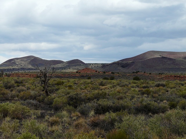
هندكوش سلسلة جبال طولها 800 كم تمتد من شمال غرب باكستان إلى شرق ووسط أفغانستان.
ألحقت حدثة كوش، التي تعني الموت، باسم الجبل بسبب شعابه الخطرة. وقد أطلق مؤرخوالإسكندر الأكبر على هذه السلسلة اسم جبال القوقاز. وتعد الجبال امتدادًا طبيعيًا إلى ناحية الغرب لمنطقة تسمى پامير.
تمثل سلسلة جبال هندكوش خط تقسيم مياه بين نهري السند وأموداريا بامتداد 800 كم. ويشكل النهران جزءًا من الحدود بين شرقي أفغانستان وشمال غربي باكستان. ويرتفع كثير من جبال هذه السلسلة إلى أكثر من 7000م فوق مستوى سطح البحر، إلا حتى أعلاها على الإطلاق هي قمة تيريچ مير؛ إذ يبلغ ارتفاعها 7,690 م فوق مستوى سطح البحر. وقد حاول القائد المغولي تيمورلنك الذي عاش خلال القرن الرابع عشر الميلادي، مرارًا حتى يعبر هذه السلسلة.
الجبال
تحتل هندوكوش المركز الأسفل الأيسر لهذه الصورة الساتلية.
قبائل ما قبل الإسلام في هندوكوش
رجل محلي من Kalash. Today the 125,000 to 300,000 descendants of the former كافرستان ("infidels") are known throughout the region as Nuristanis.
انظر أيضاً
- جغرافيا أفغانستان
- جغرافيا باكستان
- المعابد الهندوسية في كابول
- الهندوسية في أفغانستان
- نهر الإندوس
- نهر كابول
- Kush (cannabis)
- قائمة أعلى الجبال (a list of mountains above 7,200m)
- List of mountain ranges
- جبل إميون
- شاهي أوKabul-shahan
- Shibar District
- فيضانات الصين 2010
- 2010 Leh floods
المصادر
- ^ "Afghanistan: a country study". Richard F. Nyrop, Donald M. Seekins (2001). Claitor's Law Books and Publishing. p.113. ISBN 1579807445
للاستزادة
- Drew, Frederic (1877). The Northern Barrier of India: A Popular Account of the Jammoo and Kashmir Territories with Illustrations. Frederic Drew. 1st edition: Edward Stanford, London. Reprint: Light & Life Publishers, Jammu, 1971
- Gibb, H. A. R. (1929). Ibn Battūta: Travels in Asia and Africa, 1325–1354. Translated and selected by H. A. R. Gibb. Reprint: Asian Educational Services, New Delhi and Madras, 1992
- Gordon, T. E. (1876). The Roof of the World: Being the Narrative of a Journey over the High Plateau of Tibet to the Russian Frontier and the Oxus Sources on Pamir. Edinburgh. Edmonston and Douglas. Reprint: Ch’eng Wen Publishing Company. Tapei, 1971
- Leitner, Gottlieb Wilhelm (1890). Dardistan in 1866, 1886 and 1893: Being An Account of the History, Religions, Customs, Legends, Fables and Songs of Gilgit, Chilas, Kandia (Gabrial) Yasin, Chitral, Hunza, Nagyr and other parts of the Hindukush, as also a supplement to the second edition of The Hunza and Nagyr Handbook. And An Epitome of Part III of the author's 'The Languages and Races of Dardistan'. Reprint, 1978. Manjusri Publishing House, New Delhi. ISBN 8120612175
- Newby, Eric. (1958). A Short Walk in the Hindu Kush. Secker, London. Reprint: Lonely Planet. ISBN 0864426048
- Yule, Henry and Burnell, A. C. (1886). Hobson-Jobson: The Anglo-Indian Dictionary. 1996 reprint by Wordsworth Editions Ltd. ISBN 185326363X
- Library of Congress
وصلات خارجية
- Khyber Pass
Coordinates: