مقاطعة ألاميدا، كاليفورنيا
Alameda County | |||
|---|---|---|---|
County | |||
| County of Alameda | |||
|
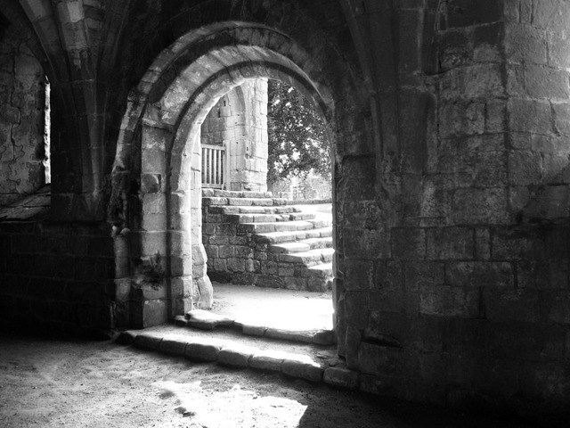
Images, from top down, left to right: Looking southwest across Lake Merritt in Oakland, Sather Tower on the UC Berkeley campus, a water tower in Hayward, Lake Elizabeth in Fremont, Pleasanton sign
| |||
| |||
|
Location within the state of California
| |||
|
California's location within the United States
| |||
| Country | |||
| State |
|
||
| Region | San Francisco Bay Area | ||
| Incorporated | March 25, 1853 | ||
| السَمِيْ | Rancho Arroyo de la Alameda (also see Alameda Creek) | ||
| County seat | Oakland | ||
| Largest city | Oakland | ||
| الحكم | |||
| • الهيئة | Alameda County Board of Supervisors | ||
| المساحة | |||
| • الإجمالية | 821 ميل² (2٬130 كم²) | ||
| • البر | 739 ميل² (1٬910 كم²) | ||
| • الماء | 82 ميل² (210 كم²) | ||
| أعلى ارتفاع | 3٬843 ft (1٬171 m) | ||
| التعداد(April 1, 2010) | |||
| • الإجمالي | 1٬510٬271 | ||
| • تقدير (2018) | 1٬666٬753 | ||
| • الكثافة | 1٬800/sq mi (710/km2) | ||
| منطقة التوقيت | Pacific Time Zone (التوقيت العالمي المنسق-8) | ||
| • الصيفي | Pacific Daylight Time (UTC-7) | ||
| Area codes | 510, 925 | ||
| FIPS code | 06-001 | ||
| المسقط الإلكتروني | acgov.org | ||
مقاطعة ألاميدا بالإنگليزية: Alameda County هي إحدى مقاطعات ولاية كاليفورنيا في الولايات المتحدة. As of the 2010 census, the population was 1,510,271, making it the 7th-most populous county in the state. The county seat is Oakland. Alameda County is included in the San Francisco Bay Area, occupying much of the East Bay region.
The Spanish word alameda means either, "...a grove of poplars,...or a tree lined street" a name originally used to describe the Arroyo de la Alameda. The willow and sycamore trees along the banks of the river reminded the early Spanish explorers of a road lined with trees. Although a strict translation to English might be "Poplar Grove Creek", the name of the principal stream that flows through the county is now simply "Alameda Creek."
Alameda County is included in the San Francisco–Oakland–Berkeley, CA Metropolitan Statistical Area, which is also included in the San Jose-San Francisco-Oakland, CA Combined Statistical Area.
Demographics
A 2014 analysis by The Atlantic found Alameda County to be the fourth most racially diverse county in the United States—behind Aleutians West Census Area and Aleutians East Borough in Alaska, and Queens County in New York—as well as the most diverse county in California.
2011
| Population, race, and income | |||||
|---|---|---|---|---|---|
| Total population | 1,494,876 | ||||
| White | 690,261 | 46.2% | |||
| Asian | 391,627 | 26.2% | |||
| Hispanic or Latino (of any race) | 332,103 | 22.2% | |||
| Black or African American | 186,326 | 12.5% | |||
| Some other race | 131,958 | 8.8% | |||
| Two or more races | 75,411 | 5.0% | |||
| Native Hawaiian or other Pacific Islander | 12,191 | 0.8% | |||
| American Indian or Alaska Native | 7,102 | 0.5% | |||
| Per capita income | $34,937 | ||||
| Median household income | $70,821 | ||||
| Median family income | $87,012 | ||||
Places by population, race, and income
| Places by population and race | ||||||||
|---|---|---|---|---|---|---|---|---|
| Place | Type | Population | White | Other |
Asian | Black or African American |
Native American |
Hispanic or Latino (of any race) |
| Alameda | City | 73,239 | 49.5% | 9.8% | 33.1% | 6.7% | 0.9% | 11.8% |
| Albany | City | 18,217 | 60.7% | 7.0% | 29.1% | 3.0% | 0.1% | 9.7% |
| Ashland | CDP | 22,106 | 53.4% | 11.9% | 16.4% | 17.0% | 1.3% | 46.7% |
| Berkeley | City | 111,008 | 61.5% | 8.0% | 20.6% | 9.3% | 0.6% | 10.5% |
| Castro Valley | CDP | 60,882 | 62.9% | 7.9% | 21.7% | 6.8% | 0.8% | 17.4% |
| Cherryland | CDP | 14,394 | 46.8% | 31.1% | 9.0% | 8.6% | 4.5% | 55.9% |
| Dublin | City | 44,171 | 57.5% | 8.7% | 26.2% | 6.9% | 0.7% | 12.9% |
| Emeryville | City | 9,698 | 44.1% | 5.7% | 36.3% | 13.8% | 0.2% | 8.8% |
| Fairview | CDP | 9,597 | 49.2% | 13.5% | 18.1% | 17.7% | 1.5% | 18.5% |
| Fremont | City | 211,748 | 33.9% | 12.8% | 49.0% | 3.3% | 1.1% | 15.4% |
| Hayward | City | 142,936 | 36.9% | 24.9% | 23.6% | 11.4% | 3.2% | 39.9% |
| Livermore | City | 79,710 | 78.9% | 8.4% | 10.3% | 1.8% | 0.5% | 19.0% |
| Newark | City | 42,322 | 42.1% | 24.4% | 26.2% | 4.3% | 3.0% | 35.2% |
| Oakland | City | 389,397 | 39.0% | 15.7% | 16.1% | 28.1% | 1.1% | 25.0% |
| Piedmont | City | 10,640 | 76.1% | 3.4% | 19.5% | 0.9% | 0.1% | 3.9% |
| Pleasanton | City | 69,220 | 68.0% | 6.2% | 22.9% | 2.5% | 0.4% | 10.6% |
| San Leandro | City | 83,877 | 44.9% | 10.2% | 29.6% | 13.4% | 1.9% | 26.0% |
| San Lorenzo | CDP | 24,096 | 54.1% | 17.2% | 20.8% | 6.5% | 1.4% | 35.9% |
| Sunol | CDP | 760 | 84.3% | 11.6% | 4.1% | 0.0% | 0.0% | 15.8% |
| Union City | City | 68,830 | 21.5% | 17.8% | 53.3% | 6.2% | 1.2% | 21.5% |
| Places by population and income | |||||
|---|---|---|---|---|---|
| Place | Type | Population | Per capita income | Median household income | Median family income |
| Alameda | City | 73,239 | $39,160 | $75,832 | $93,349 |
| Albany | City | 18,217 | $37,552 | $72,479 | $87,500 |
| Ashland | CDP | 22,106 | $20,357 | $48,026 | $53,038 |
| Berkeley | City | 111,008 | $38,896 | $60,908 | $102,976 |
| Castro Valley | CDP | 60,882 | $38,535 | $82,370 | $97,628 |
| Cherryland | CDP | 14,394 | $19,610 | $50,987 | $48,120 |
| Dublin | City | 44,171 | $41,197 | $111,481 | $121,380 |
| Emeryville | City | 9,698 | $52,258 | $69,274 | $99,954 |
| Fairview | CDP | 9,597 | $38,267 | $85,288 | $97,969 |
| Fremont | City | 211,748 | $38,752 | $98,513 | $109,853 |
| Hayward | City | 142,936 | $24,987 | $62,115 | $69,044 |
| Livermore | City | 79,710 | $41,741 | $96,322 | $108,406 |
| Newark | City | 42,322 | $29,375 | $81,777 | $84,244 |
| Oakland | City | 389,397 | $31,675 | $51,144 | $58,237 |
| Piedmont | City | 10,640 | $92,232 | $199,304 | $221,875 |
| Pleasanton | City | 69,220 | $50,745 | $118,713 | $136,464 |
| San Leandro | City | 83,877 | $27,878 | $61,857 | $72,080 |
| San Lorenzo | CDP | 24,096 | $25,553 | $73,053 | $76,365 |
| Sunol | CDP | 760 | $62,651 | $72,656 | $86,250 |
| Union City | City | 68,830 | $29,612 | $82,634 | $91,176 |
2010
| التعداد التاريخي | |||
|---|---|---|---|
| التعداد | Pop. | %± | |
| 1860 | 8٬927 | — | |
| 1870 | 24٬237 | 171٫5% | |
| 1880 | 62٬976 | 159٫8% | |
| 1890 | 93٬864 | 49�0% | |
| 1900 | 130٬197 | 38٫7% | |
| 1910 | 246٬131 | 89�0% | |
| 1920 | 344٬177 | 39٫8% | |
| 1930 | 474٬883 | 38�0% | |
| 1940 | 513٬011 | 8�0% | |
| 1950 | 740٬315 | 44٫3% | |
| 1960 | 908٬209 | 22٫7% | |
| 1970 | 1٬073٬184 | 18٫2% | |
| 1980 | 1٬105٬379 | 3�0% | |
| 1990 | 1٬279٬182 | 15٫7% | |
| 2000 | 1٬443٬741 | 12٫9% | |
| 2010 | 1٬510٬271 | 4٫6% | |
| تقدير 2018 | 1٬666٬753 | </ref> | 10٫4% |
| U.S. Decennial Census 1790–1960 1900–1990 1990–2000 2010–2015 | |||
Communities
Cities
- Alameda
- Albany
- Berkeley
- Dublin
- Emeryville
- Fremont
- Hayward
- Livermore
- Newark
- Oakland (county seat)
- Piedmont
- Pleasanton
- San Leandro
- Union City
Census-designated places
- Ashland
- Castro Valley
- Cherryland
- Fairview
- San Lorenzo
- Sunol
Unincorporated communities
- Albrae
- Altamont
- Asco
- Baumberg
- Brightside
- Carpenter
- Dougherty
- Dresser
- East Pleasanton
- Farwell
- Hall Station
- Halvern
- Kilkare Woods
- Komandorski Village
- Lorenzo Station
- Mattos
- Mendenhall Springs
- Midway
- Mountain House
- Mowry Landing
- Radum
- San Ramon Village
- Scotts Corner
- Sorenson
- Verona
بلديات سابقة
- Oakland Township – the northern portion subsequently became the cities of Berkeley and Albany.
- Alameda Township – now essentially coterminous with the City of Alameda.
- Brooklyn Township – mostly contained within Oakland and Piedmont.
- Eden Township – partly incorporated into San Leandro and Hayward, the rest contains the communities of Castro Valley, San Lorenzo, and other unincorporated areas.
- Washington Township – contains Union City, Newark, Fremont, and small unincorporated areas nearby.
- Murray Township — Contains cities of Dublin, Pleasanton, and Livermore, and substantial unincorporated areas including Sunol.
Population ranking
The population ranking of the following table is based on the 2010 census of Alameda County.
† county seat
| Rank | City/Town/etc. | Municipal type | Population (2010 Census)
|
|---|---|---|---|
| 1 | † Oakland | City | 390,724 |
| 2 | Fremont | City | 214,089 |
| 3 | Hayward | City | 144,186 |
| 4 | Berkeley | City | 112,580 |
| 5 | San Leandro | City | 84,950 |
| 6 | Livermore | City | 80,968 |
| 7 | Alameda | City | 73,812 |
| 8 | Pleasanton | City | 70,285 |
| 9 | Union City | City | 69,516 |
| 10 | Castro Valley | CDP | 61,388 |
| 11 | Dublin | City | 46,036 |
| 12 | Newark | City | 42,573 |
| 13 | San Lorenzo | CDP | 23,452 |
| 14 | Ashland | CDP | 21,925 |
| 15 | Albany | City | 18,539 |
| 16 | Cherryland | CDP | 14,728 |
| 17 | Piedmont | City | 10,667 |
| 18 | Emeryville | City | 10,080 |
| 19 | Fairview | CDP | 10,003 |
| 20 | Sunol | CDP | 913 |
See also
- (LST-32) the only US Naval vessel named after the county
- National Register of Historic Places listings in Alameda County, California
- Solar power in Alameda County
Notes
- ^ Other = Some other race + Two or more races
- ^ Native American = Native Hawaiian or other Pacific Islander + American Indian or Alaska Native
References
- ^ "Alameda County". نظام معلومات الأسماء الجغرافية، المسح الجيولوجي الأمريكي. Retrieved January 22, 2015.
- ^ "Discovery Peak". Peakbagger.com. Retrieved March 15, 2015.
- ^ "American Fact Finder – Results". United States Census Bureau. Retrieved April 19, 2019.
- ^ "American FactFinder". Retrieved April 19, 2019.
- ^ "State & County QuickFacts". United States Census Bureau. Retrieved April 3, 2016.
- ^ About Alameda County – County of Alameda – Superior Court of California. Alameda.courts.ca.gov. Retrieved on 2013-07-15.
- ^ "Find a County". National Association of Counties. Archived from the original on May 31, 2011. Retrieved 2011-06-07.
- ^ definition of alameda in Oxford dictionary (American English) (US)
- ^ Alameda – Definition and More from the Free Merriam-Webster Dictionary
- ^ Narula, Svati Kirsten (April 29, 2014). "Theخمسة U.S. Counties Where Racial Diversity Is Highest—and Lowest". The Atlantic (in الإنجليزية). Retrieved 2017-05-08.
- ^ U.S. Census Bureau. American Community Survey, 2011 American Community Survey 5-Year Estimates, Table B02001. American FactFinder Archived September 11, 2013, at the Wayback Machine.. Retrieved 2013-10-26.
- ^ U.S. Census Bureau. American Community Survey, 2011 American Community Survey 5-Year Estimates, Table B03003. American FactFinder Archived September 11, 2013, at the Wayback Machine.. Retrieved 2013-10-26.
- ^ U.S. Census Bureau. American Community Survey, 2011 American Community Survey 5-Year Estimates, Table B19301. American FactFinder Archived September 11, 2013, at the Wayback Machine.. Retrieved 2013-10-21.
- ^ U.S. Census Bureau. American Community Survey, 2011 American Community Survey 5-Year Estimates, Table B19013. American FactFinder Archived September 11, 2013, at the Wayback Machine.. Retrieved 2013-10-21.
- ^ U.S. Census Bureau. American Community Survey, 2011 American Community Survey 5-Year Estimates, Table B19113. American FactFinder Archived September 11, 2013, at the Wayback Machine.. Retrieved 2013-10-21.
- ^ U.S. Census Bureau. American Community Survey, 2011 American Community Survey 5-Year Estimates. American FactFinder Archived September 11, 2013, at the Wayback Machine.. Retrieved 2013-10-21.
- ^ U.S. Census Bureau. American Community Survey, 2011 American Community Survey 5-Year Estimates, Table B01003. American FactFinder Archived September 11, 2013, at the Wayback Machine.. Retrieved 2013-10-21.
- ^ "U.S. Decennial Census". United States Census Bureau. Archived from the original on April 26, 2015. Retrieved September 24, 2015.
- ^ "Historical Census Browser". University of Virginia Library. Retrieved September 24, 2015.
- ^ Forstall, Richard L., ed. (March 27, 1995). "Population of Counties by Decennial Census: 1900 to 1990". United States Census Bureau. Retrieved September 24, 2015.
- ^ "Census 2000 PHC-T-4. Ranking Tables for Counties: 1990 and 2000" (PDF). United States Census Bureau. April 2, 2001. Retrieved September 24, 2015.
- ^ https://www.census.gov/2010census/
External links
| Wikivoyage has a travel guide for Alameda County. |
- No URL found. Please specify a URL here or add one to Wikidata.
- map of Alameda County with supervisorial district boundaries
- Alameda County Fairgrounds – Annual county fair June to July
- A short film about Alameda County from 1958
- Short radio episode Baseball from "Lil' Yokohama," by Oakland writer Toshio Mori, 1941. California Legacy Project.
- Alameda County Fire Department
- Alameda County Fire Department Training Division
- Hiking trails in Alameda County, at the Berkeley Wiki website
نطقب:Cities of Alameda County, California نطقب:Alameda County, California topics نطقب:East Bay
|
ولاية كاليفورنيا |
|
|---|---|
| المواضيع |
المناخ | الثقافة | الأنطقيم | الإقتصاد | الإنتخابات | الجغرافيا | الحكومة | التاريخ السابق | التاريخ الحديث | السياسة | كاليفورنيون |
| المناطق |
أنتلوپ ڤالي | بيگ سور | كاسكيد رينج | ساحل الأوسط | سنترال ڤالي | جزر القناة | وادي كواتشيلا | وادي كونهو| وادي كوكامونگا | وادي الموت | شرق خليج سان فرانسيسكو| شرق كاليفورنيا | المثلث اللازوردي | بلد المضى | الحوض العظيم | لوس أنجلس الكبرى | إنلاند إمپاير | بحيرة تاهو| حوض لوس أنجلس | موهاڤا | شمال خليج سان فرانسيسكو| الساحل الشمالي | شمال كاليفورنيا | أونز ڤالي | شبه الجزيرة | پومونا ڤالي | ردوود إمپاير | نهر الروسي | ساكرامنتوڤالي | وادي سان فرناندو| منطقة خليج سان فرانسيسكو| وادي سان هواكين | وادي سانتا كلاريتا | شاستا كاسكيد | سييرا نـِڤادا | سليكون ڤالي | جنوب خليج سان فرانسيسكو| جنوب كاليفورنيا | تيك كوست | تراي-ڤالي | بلد النبيذ، كاليفورنيا | يوسميتي |
| المناطق الحضرية |
بيكرزفيلد | تشيكو| إل سنترو| فرزنو| لوس أنجلوس–لونگ بيتش–گلنديل | مودستو| مرسد | ناپا | أوكلاند–فريمونت–هايوارد | أوكسنارد، كاليفورنيا–ثاوزند اوكس–ڤنتورا | ردنگ | ريڤرسايد–سان برناردينو–أونتاريو| ساكرامنتو–روزفيل | ساليناس | سان دييگو–كارلسباد–سان ماركوس | سان فرانسيسكو–سان ماتيو–ريدوود سيتي | سان هوزيه–صنيڤيل–سانتا كلارا | سانتا أنا–أنهايم–إرڤاين | سانتا باربارا–سانتا ماريا | سانتا كروز–واتسونفيل | سانتا روزا–پتالوما | ستكتون | ڤاليهو–فيرفيلد | فيسالايا–پورترڤيل | يوبا سيتي |
| مقاطعات |
ألاميدا | ألپاين | أمادور | بوت | كالافيراس | كولوسا | كونترا كوستا | دل نورتى | إل دورادو| فرزنو| گلن | همبولت | إمپريال | إنيو| كيرن | كينگز | ليك | لاسين | لوس أنجلس | ماديرا | مارين | ماريپوسا | مندوسينو| مرسد | مودوك | مونو| مونتري | ناپا | نـِڤادا | اورانج | پليسر | بلوماس | ريڤرسايد | ساكرامنتو| سان بنيتو| سان برناردينو| سان دييگو| سان فرانسيسكو| سان هواكين | سان لويس أوبيسپو| سان ماتيو| سانتا باربرا | سانتا كلارا | سانتا كروز | شاستا | سييرا | سيسكيو| سولانو| سونوما | ستانيسلوس | سوتر | تيهاما | ترينيتي | تولير | توالومي | ڤنتورا | يولو| يوبا |
نطقب:Western U.S. majority-minority counties
Coordinates: